Friday, March 15, 2019

Newsletter No. 14 ----Petrified Wood


Petrified wood caught our attention this month due to an old “cedar” fence post that we have stored here.  Now, how many of you have an old fence post that you have had stashed away for years?  More on that later, but for now, what the heck is petrified wood?  The word comes from the Greek language, where petro means stone or rock.  In fact, variations of the word petro show up in place names and even the names of people.  We know a person in San Marcos whose first name is Petra, of Dutch origin.

So, petrified wood is where the organic material is replaced with inorganic material over long periods of time.  The process is called permineralization.  This process occurs when mineral laden water slowly  replaces organic material as it decays.  It must occur slowly because if the wood decomposes rapidly---let’s say to rot or to be eaten by termites, there is no time for the slow process of permineralization to replace the organic cell structure. This replacement process must therefore occur underground where there is no oxygen to facilitate the rapid decay of wood cells. 

The “recipe” for petrifaction then is (a) an environment with very little oxygen—probably not zero oxygen, but close to it (b) mineral laden water, and (c) time, lots of time.

The environment of very little oxygen usually exists several feet underground.  Wood occurring underground usually happens due to sedimentation where soil is deposited on top of forests materials.  For example, Exxon plastics plant contracted with a gas well driller to place a well on company property at Mont Belvieu, northeast of Houston years ago.  The site was about a mile away from Cedar Bayou.  I often would go to the drillers control room and chat about the process of drilling and one day he said that he found something interesting.  At about 40 feet down, soon after the start of drilling, he came upon a cypress log or stump because his drill bit kept bringing up bits of wood.  Thousands of years ago, this was probably a tree growing on the banks of Cedar Bayou, now a mile way.  So over many years, the bayou changed course and lots of sediment overfilled the area.  You can bet this wood was on its way to becoming petrified wood. All that it lacked was time, lots of time.

The minerals in this process of permineralization are mainly silicates and for the most part are not colorful.  But some petrified wood is colorful and it is due to trace impurities in the mineral water—impurities, mainly metals such as chromium, copper, zinc, manganese, etc.  The petrification process provides paleontologists with a lot of information because the process of petrifaction reproduces the cell structure of organic materials in great detail.   Thus when we see a petrified log, we can tell what kind of tree existed in the area from just examining the cell structure. From these studies, we know that palm trees grew in Texas thousands of years ago and we know from the petrified dung of dinosaurs what they had for lunch.

Petrified wood can be found nearly everywhere in the world. In some localities it is so abundant and undisturbed that governments have protected these artifacts by creating preserves.  One such preserve in the United States is in Arizona, the Petrified Forest National Park.  Here, whole logs in sizeable lengths can be easily viewed on the surface. Here is one such example from the National Forest:


Arizona petrified wood is especially colorful and so it was a good move to create this National Park as these specimens were rapidly disappearing due to their value in polishing the surface to show the beauty of the stone and selling them as bookends, etc. A search of the internet would suggest that a five pound chunk of this colorful wood might cost up to a thousand dollars today.  Forty years ago, when we did most of our collecting, we bought really colorful petrified wood for no more than a dollar per pound.  Here is one piece still hanging around.


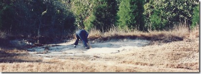
Petrified wood can be found in nearly every part of Texas, some places easier than others.  In some areas, it can be found on the surface, but only in small pieces.  In other areas, such as in east Texas, it occurs in larger pieces, but usually one has to either dig for it, or search along the sides of riverbanks, road cuts or any excavations that reveal pieces of stone.  Here is a photo of a nice piece of palm wood that we found in the Lake Livingston area of our state when the excavation for the reservoir was underway.


Below is a photo of another chunk, not very colorful, from the same area, and from an unknown wood.  Both these chunks of wood each weigh about five pounds.


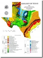
Although petrified wood can be found in nearly every part of Texas, it is more commonly found in a band that courses  through east Texas then curves southward to the Rio Grande.  Pulling up the surface geology map we used in the geology discussion, it’s where the rocks from the Cenozoic era are on the surface or near the surface.  These are the rocks that are from 40 to 60 million years old.


The petrified wood zone of most interest is the dark- brown band that courses from the Sabine to the Rio Grande.[1]


If the Permian Highway Gas Pipeline ever gets through this area, it will surely be interesting to see what the trenching machine unearths as it progresses through the region to the east of here.  A nine foot deep trench should provide some good prospecting.

Now back to the fencepost.  As I was replacing fence posts in Medina years ago, I noted that some that were being pulled out of the ground were heavy for their size.  I put one aside and saved it.  The posts were in the ground for at least the last 80 years.  They were not rotting, nor termite chewed, just weathered.  This one calculates to have a specific gravity of about 1.14 which means the wood will not float in water.  Why is this wood so heavy? Most likely, water from the ground saturated with silica was pulled up by capillary action into the post.  The water evaporated and left the silica in the pores of the wood.  This post must be a small fraction of the way to being a petrified log.  But it would never make it for the million year trip because just weathering would make it disappear long before petrifaction could occur.

 Interesting, nevertheless.


History of the Area (continued)

In an earlier edition, roads in the area were one of the subjects and now we have some more specific information.

Roads in the time when Hays County was first settled were trails more than they were roads as we now might define a road.  When the state first became organized to the extent that it had a road department, the road department issued standards for new roads.  One standard was that when the roadbed was cleared, the trees that were cleared had to be cut so that the stumps that remained were not more than 6 inches high.

Here is a copy of the map (Map No. 16848 from Texas GLO) of our area.   The map is dated 1880, long before the advent of cars, so these roads are trails for wagons, cattle herds, and horses. 


If you can expand the view, you will see that there are two roads that leave San Marcos and travel west.  One, the lower one, is labeled Purgatory Road; the upper one is labeled Wimberley Road.   These two roads are one as they leave San Marcos, but split soon after leaving San Marcos.  It appears that they may have parted where the Fulton Ranch Road branches off from RR 12 today.  The Road to Purgatory then continues on what is now Hugo Road.  So why did the early settlers choose the Hugo Road track instead of the RR12 (of today) to get to Purgatory Springs?  For at least two reasons:  (1) trail blazers always followed stream beds to have the best chance at water supplies for themselves  and their horses and (2) following stream beds usually gives a path with a more or less constant grade.  If you drive to Purgatory Springs area (the intersection of current Purgatory Road and RR 32) via Hugo Road, there are fewer steep grades and reversals than if you drive to Purgatory via today’s RR 12/RR 32.

We are still looking for original source information on the origin of the name Hugo.  We do know that the original name for the area was Purgatory Springs, then it became Hugo.  Our focus at the moment is the USPS records where we learned that the Purgatory Springs P.O. was in operation from June 1890 to August 1895 when it closed and all mail was directed to Fischer Store.  Only a year later, November 1896 the Hugo Post office was opened, probably in the same store where the Purgatory Springs P.O. was a year earlier.  What we are trying to determine is what caused the renaming of the reopened post office.  One reason could be traced to Postmaster General Order114 issued in 1849 that  . . . “from this date only short names or names of one word will be accepted.”  Many other additions such as “. . . store, station, springs, etc. were considered objectionable”. Purgatory by itself could have been objected to by the USPS and the community itself.  Local oral history says that it was named Hugo after a family ancestry of the 1300’s but we need to substantiate this if possible. Incidentally, this newly opened post office only lasted 12 years.  When it closed, all mail was directed out of San Marcos.

Sightings

The wild plum trees are blooming this week.  Here is ours; it is this tree’s first ever bloom being only 6 years old. It was started from a plum that had fallen to the ground.


There are two other wild plum trees blooming, one just to the west of the Upshaw property and another on the Miller property. They are easy to spot because of the abundance of white blooms when nothing else is showing.

R & D Tusch


[1] Do an internet search for rock hounding Texas San Jacinto River for petrified wood and several videos will come up.

Saturday, February 23, 2019

Newsletter No. 13-----Ashe Juniper and Some History


Ashe Juniper (juniperus ashei)
This evergreen is commonly called Mountain Cedar, but of course it is not a cedar. The question persists about whether the benefits outweigh the harm it causes or vice versa.


Susan Wilkinson alerted us to a Central Texas Gardener show she saw recently featuring Elizabeth McGreevy, (the cedar lady) talking about the benefits of Mountain Cedar and the mistaken information that still seems to persist.[1] McGreevy has been interested in the junipers for many years and has been taking informed notes, which will be part of her book being published and available for sale in August of this year.
It is a known fact that Ashe junipers are native to this area and they have been since the Ice Age. [2] And 174 years ago Ferdinand Lindheimer wrote to George Engelmann “The cedars form wide strips of forest along the river banks.”[3] This is followed by a description of land 20-40 miles north of the Comal and includes, ”The peaks of the hills are bare. By the banks of the little rivers there are still a few sorts of trees, mostly elms; otherwise cedars on the slopes of the hills and in low-lying places.” Oct. 10, 1846 he wrote about collecting the #20 Geranium. “It grows in the hills, you see, on the plateau, which is here 200’ high, full of ravines that are densely covered with cedars and underbrush, and to which one has few ways of access along the slopes.”[4]
However, Lindheimer’s writings are not sufficiently descriptive to determine if there are more or less junipers on the area land today than there were a couple hundred years ago.
What we do know is that two significant enemies of the juniper have disappeared. One is the grassland fire and the other is the so called cedar cutter. Grass fires are not allowed to run out of control anymore and cedar cutters for fence posts have been replaced by steel posts. This shift occurred 40 or 50 years ago. Only recently has equipment appeared that will destroy junipers and everything in its path. Its only limitation is the cost of their operation.
As an aside, here is Ferdinand Roemer’s description of a prairie fire in July, 1846 seen with Mr. John Torrey on their way from New Braunfels to Torrey’s Trading Post N.W. of Bryan-College Station. They were camped for the night and”[5]….were entertained before going to sleep by the beautiful spectacle of a prairie fire. Like a sparkling diamond necklace, the strip of flame, a mile long, raced along over hill and dale, now moving slowly, now faster, now flickering brightly, now growing dim. We could more enjoy this spectacle undisturbed since the direction of the wind kept it from approaching us. My companion was of the opinion that Indians had without doubt started the fire, since they do this often to drive the game in a certain direction, and also to expedite the growth of the grass by burning off the dry grass.”
Ashe Junipers although called cedars by some are not cedars but are coniferous trees of the cypress family Cupessaceae. Not very far to the east of us the Juniper ceases to exist and the similar tree is the Eastern Red Cedar. Unlike the juniper it always has a singular trunk and its wood is often used for paneling because the grain is attractive and the wood is aromatic. This eastern red cedar is not part of the cypress family.
Female Ashe Juniper trees produce berries and the males produce pollen. And this has been an especially productive year for the males because of the rain we have had. Supposedly, this has been the worst year in 21 years for cedar related allergies. Hence, the problems many of us have had with “cedar fever”. The season started earlier and is expected to last a bit longer than usual. According to Ms. McGreevy its effects are increased by wind activity, pollution and the consumption of sugary foods.
Like everything in nature, the Ashe juniper is connected to many other systems. One interesting bit of information is the symbiotic relationship the juniper has with the Texas Madrone. If you have never seen a Texas Madrone, make point to do so. It’s a small tree that has smooth bark resembling a crape myrtle. On our place in Bandera County we found that Madrone seeds would only germinate underneath a Juniper. A Bandera County horticulturalist was studying this a few years ago. We are bringing some seeds from the area and will plant them under some Junipers here to continue our experimentation.
Because all things in nature are interconnected, this creates a rather long list of benefits and detriments—some diametrically opposite the other. Therefore without fact based study, this creates a lively discussion among hand-me-down experts regarding what is important in the decision to clear out the junipers. To mention just a few, the juniper provides food for wildlife, nest making material for the Golden Cheeked Warbler, humus for soil building, erosion control, wind breaks, privacy screens, mature tree shade and several others. But, they do block the growth of native grasses; prevent brief rains from reaching the ground, etc. The most significant controversy with Ashe junipers is the accusation that they are water guzzlers. The Native Plant Society of Texas [6] explores this in a question “Mountain cedar- water guzzler or not”? Junipers may not consume a lot of water as much as they prevent brief rains from reaching the ground to soak in.
So, size up your own situation with regard to the juniper population. Have you so many that grass can’t become established, then selectively cut the smaller ones. No junipers at all? Probably should not plant any as they do that pretty well on their own.
Navel Oranges

For those of you who don’t get The Daily Record, Joe Urbach has been having some interesting Sunday columns on fruits. Urbach, a 30 year resident of Central Texas is a Hays, Co. Master Gardener who is affiliated with the Master Gardener Program. On January 20 he wrote about navel oranges.


He receives many questions about seeds to grow navels and has to tell interested parties that they don’t exist. There are no seeds and when pulled apart the orange has a little mini orange inside. He consulted orange historian Vince Moses for the answer to this conundrum. Turns out it is a mutation which forms another undeveloped orange at the opposite end from the stem that looks like a human navel. The mutation was found on a single stem of a sour orange tree in a monastery garden in Brazil.

Next it was discovered by a missionary in the mid 1800s. He recognized it as unique; it was juicy, sweet and seedless. He made a cutting, propagated some trees and sent them to William Saunders at the U.S. Dept. of Agriculture in Washington. Moses says that all the navels we see today are genetically the same as the original mutated orange. The only way to grow navels is to graft a bud onto a compatible fruit tree’s trunk or root, such as grapefruit, lemon or lime.
Mr. Saunders (not the Saunders that follows) had a neighbor Eliza Tibbets. She and her husband had suffered a financial loss and decided to head for California. Saunders gifted her with three little starter trees and she cared for them faithfully on the trip and in her yard in Riverside, CA. That was in 1872 and they responded well to the mild climate and two of them rewarded her at first with a few oranges and later with bushels of navels.
And this was the beginning of the navel orange industry as other growers decided to take buds from Eliza’s trees. By 1882 500,000 navel orange trees were growing in California, many of them Tibbets’ grafts. This variety of navel was first called Riverside Orange, but it was changed later to Washington Navel Orange and now it’s the most popular type of navel in the world.
If you are interested in trying to grow a navel orange tree, please check with the library or the newspaper and read his whole article.
The history of the Williamson-Saunders family of Purgatory Springs continues in Wimberley, Texas.[7]
The Saunders had five girls when the 6th was born, a boy, to carry on the family name. When John Henry Jr. was 5 months old the family moved about 2 miles down the road from Purgatory Springs to a place they called “over in the Hollow” where the hunting was better and they could raise mohair goats, cattle, corn, cotton and cane. They sold the cane sorghum by the barrel and mohair twice a year when they sheared the goats. They also added three more children to the family: William Edgar, Rosie Mabel and Thomas Joseph.
John Henry Sr. still taught school in Wimberley, sold horses and also quarried and dressed stone for the home they planned to build near San Marcos.
They had saved all the money they could over the years in a special fund so they could move to San Marcos and send their children to the Coronal Institute. This plan, however, did not work out as John Henry Sr., to help out a friend, co-signed a note with Pleasant Wimberley and ended up having to pay it off with the special education fund.
Pleasant was an honest man and deeded his land over to the Saunders which consisted of a house, store and field. And on February 26, 1888 the family moved to Wimberley to farm the land and run the store. The Saunders only stayed in the house a few months before buying and moving into the J.P. Laney house where Louis Yell was born in August. This property across The Square from Pleasant’s store came with a wood frame store that Saunders tore down when he built the rock store in 1890. He used the wood to build rooms between the house and rock store. They were rented or used for the homeless or aged and later as bedrooms for the boys. The rock store carried both general merchandise and dry goods and as soon as it was finished, all of the merchandise was moved across The Square from P. Wimberley’s old store to it. A U.S. Post Office was located in the S.E. corner of the building and John Henry Sr. was appointed postmaster twice (1890-1892 and 1902-1907). When the girls were older, Virginia and Lillie had day jobs as postal clerks.
John Henry Sr. did not teach school any longer. He focused on running the store, ranching, farming, selling horses and working for the betterment of Wimberley especially in education. He gave the land for the school and cemetery and also served as County Commissioner Precinct 3. The family settled into Wimberley, the children went to school there, roamed the creek and river and played games on The Square. The Saunders had 13 children and reared a family orphan as well. As they sat down at the table Dad and Mother were at the head and foot with girls on one side, boys on the other.
This is the Saunders’ old home in Wimberley. As one approaches the Square on 12 just past the cutoff road on the right this building can be noticed. Note the Historical Marker on the left that tells about the Saunders house. As one passes it and goes over Cypress Creek it’s possible to see how its backyard slopes down to the creek.


One of John Henry’s many betterment projects was to install the first water system by using a “hydraulic ram” system to lift water uphill from Cypress Creek to a huge holding tank. The tank’s platform was high enough to provide gravity flow to a hydrant in the kitchen and one on the porch. He offered to help anyone else who wanted to copy his system.
In 1906 the office of County Superintendent of Hays County was created. John Henry Saunders Sr. was appointed to the office and at the next election was elected to the office for as long as he wished to hold it. The family moved to San Marcos and traded their home in Wimberley to The Oldham family for their home on N. Comanche. A short time later he bought a home at 1109 W. San Antonio Street. He served as the County Superintendent for about 10 years and died on November 3, 1919. Much beloved, the schools were closed the day of his funeral and flags were flown at half staff. He was buried in the San Marcos Cemetery where Callie Saunders was interred beside him in 1930.
Callie and John Henry Saunders:

Sightings
On several occasions this week, a flock of some twenty Yellow Warblers all together were spotted in a short bush. They must be on their way north to their nesting grounds.
The American Kestrals are back. The kestral is a falcon, it is most commonly spotted on the telephone wires in BWR this time of the year searching for its next meal which would consist of large insects to small birds, whichever it may find tasty. This bird was commonly called a sparrow hawk or chicken hawk. The kestral doesn’t seem to nest here although the range map shows that the year around area covers central Texas. Later in the spring, we think they leave and go further north to nest.
R & D Tusch

[1] That show can be seen at htts://youtube.com/watch?v=Aeet3of)A5w.
[2] Thirty years of research by Robert P. Adams of Baylor University. Juniperus ashei has existed in The Hill Country for thousands of years; a conclusion based on carbon dating pollen.
[3] The lower part of the Comal River. Aug.,1845
[4] These quotes are from A Life Among the Texas Flora by Minetta Altgelt Goyne.
[5] Roemer’s Texas 1845-1849 by Dr. Ferdinand Roemer.
[6] Posted on August 15, 2010 by Bill Ward.
[7] Many thanks to David Williamson for his family history of the Williamsons. And Dorothy Wimberley Kerbow for “The John Saunders House Wimberley, Texas”


Tuesday, January 15, 2019

Newsletter No.12----- Birds and History

A Day for the Birds
On December 16 we joined 8 of our BWR neighbors in giving Bryan Tarbox of TSUs Biology Dept. and his group of birders access to our property for the San Marcos Christmas Bird Count. Bryan had scouted the area the week before with our permission so he knew our area well. After counting another area near the university in the morning, his group of four arrived here around 1pm and worked until dark.
According to Bryan, the Sage Thrasher (below) was the highlight of the day.

After tabulating the results, Bryan sent all of us the total count for BWR and the various birds found on each property. Also, we were invited to join the birders if we were so inclined. There is no doubt that we will sign up again in 2019. And in the meantime peruse the sparrow bird book pages as seven different sparrows were identified on our property. We missed seeing the 418 robins on our property on the day of the count, but on the morning of December 28 we were delighted by a huge flock of robins in the front yard flitting around in the trees and pecking on the ground.
If any of you would like a pdf copy of the total results of the BWR bird count and where the birds were found, let us know and we’ll send it off to you.
We found this whole endeavor so interesting that we looked into the history of the Christmas Count. It evolved from the Christmas “Side Hunt” a tradition popular prior to 1900 involving guns rather than binoculars. The groups involved chose sides and each side killed as many feathered and furred creatures as possible within a certain time limit. The side with the most casualties was proclaimed the winner.
The idea of conservation was just beginning and in 1900 ornithologist Frank M. Chapman, worried about the declining bird population, proposed a “Christmas Bird Census” that would involve counting birds rather than killing them. The first count included 27 dedicated birders who participated in 25 bird counts. Most took place in N.E. North America, but they did range west to Pacific Grove, California. And the counts have been going on ever since, providing important information on the birds’ migratory patterns, their food sources and their habitats. Just as we saw right here a few years back when we had an invasion of mice. We also had an increase in our owl population and noticed a snake coiled near the bird feeder waiting for the birds to send down some seed to attract the mice it had planned for breakfast. Then the mice left, the owls followed and the snake had to work harder for breakfast.
The Audubon Society at the following site has some very interesting 4 minute videos of dedicated birders working on their bird count lists in Pautuxet, Maryland, Baton Rouge, Louisiana, Mad Island, Texas and Irruptive Species in Maine.
www.audubon.org/conservation/history-christmas-bird-count

The Nature of the Place
This month we’re going to interpret the word nature as ‘the nature of something’ and apply it to the areas of Hugo and Purgatory Roads. And that includes the history that influenced how the land was settled and how it changed over the years.
In chatting with a local rancher who has lived on Hugo Rd. for a very long time, we learned that an old one room school still exists on Purgatory Rd. although it hasn’t served as a school for many years.

That conversation intensified our interest in that general area, and we began to probe for more details. What we found was that in the late 1800s, there were sufficient residents of the area to have formed a small settlement. This small settlement was called Purgatory Springs supposedly because a young lawyer named Massey got lost here and wandered around for hours before making it home. When asked by his family where he had been, he told them he was in purgatory. It could be that Massey was exploring the area as there were only two roads leading westward from San Marcos, one called the Wimberley Road and the other was Purgatory Road. The Purgatory Road followed the same road bed as present day Hugo Road. This is all shown on a 1881 map. Keep in mind that there were no cars at that time so one can envision wagons plying their way back and forth to Purgatory right past BWR’s gate.
Purgatory Creek, the creek we know here in BWR starts way up in the hills just north of RR 32, near the intersection of Purgatory Road and RR 32. The creek, when it rains, flows down south from that point on the eastern side of Purgatory Road, crossing the road very near the intersection of Hugo Road with Purgatory Road, then back under Purgatory Road to the stock tank and on toward BWR.
Historical accounts have documented that this settlement consisted of a store, a post office, a school, a cemetery and a church. The school, the home of Joseph and Elizabeth Williamson, and the cemetery are the only physical remains of the old settlement. When the post office was established in 1896, it was thought that Purgatory Springs was not a fitting name for a post office and so the name Hugo was chosen instead. We are still working on the origin of the name Hugo; but according to one source, it may have originated from an old name in the Williamson family.[1]
Recently in talking to the owner of the old one-room school we confirmed its existence. It is painted red and sits in the woods on the right side of Purgatory Rd.[2]
As reported in Clear Springs and Limestone Ledges A History of San Marcos and Hays County, the first school was a log building followed by the red building in the same location. From various historical sources it appears that the school was established on January 9, 1877 with 17 pupils. John Henry Saunders, the first teacher, taught grades one through seven. Oscar Owen donated a one acre tract of land for the new school, three trustees were chosen and families in the community made contributions for the materials that went into the frame structure.
From the San Marcos Record, October 15, 1970, we learned that a Hugo School Reunion was held on Saturday night at Carson’s Restaurant in San Marcos. About 40 people were present, 25 prior pupils plus spouses and friends. And during the “gab session” that followed the dinner, they reminisced about the difficulty of getting to school back in their day.
The old school on Purgatory Road.


Some came on horseback, some walked and Jessie Nowotney Metz, currently of Austin, “made her journey to school and back on a donkey.” They carried their lunches in lunch buckets and many times traded the contents. It is interesting to note that kids traded lunch then just as we did in the 1940s. They carried drinking water in buckets from a small store next door and “…trips to Hall’s Store for fresh buckets were frequent.” Their other memories included baseball games, Christmas programs and holidays. Other reunions followed, with the last being recorded in the San Marcos Daily Record of October 7, 1978.
The school was closed and the students were bused to San Marcos sometime between the years 1920 and 1940. [3] The school house was sold by the San Marcos School Board in the 1950s. The new owner says that back then there was still evidence of the foundation of Hall’s store that had contained the old Hugo Post Office which existed from 1896 to 1909 with Elizabeth Fox as the first Hugo Post Mistress. However, new owners of that property had the area bulldozed and nothing remains anymore.
One of the earliest homesteads in Purgatory Springs was built by Joseph Williamson and his wife Elizabeth. Born in Tennessee, Joseph and his wife came to San Marcos, TX in 1851 and built a house where the Methodist Church is today. After a bit of time they moved again, this time to the Hill Country to Purgatory Springs. They homesteaded 640 acres, enough land for each of their children and themselves to have farms. Their old board house has been replaced with stone but still stands on the same site on RR 32 across the road from its junction with Purgatory Road. Joseph specialized in raising pigs and there are still many outbuildings and fences to be seen as well as three old oak trees. One of which must have been the one where he hung his basket of shucked corn for the pigs and another under which his granddaughter was married.
The last remaining physical feature of old Hugo is the Hugo Cemetery. It lies south on Purgatory Rd. from RR 32 on a small hill that rises on the right side of the road. There is a place for a car to park off the road and then one can walk up to the open gate. This one acre plot was set aside as a cemetery by the Joseph Williamsons.


For at least 163 years the Joseph Williamson Sr. family and their relatives have been buried here. When the town was renamed Hugo, the cemetery followed suit. The trees you see in the picture are trimmed cedars that provide shade, but still maintain a light and airy look to the promontory.
According to a cemetery listing, members of the family continue to care for the site and it looks very nice with various beds of what look like cemetery iris. We will definitely make a point in April to check the blooms and see if they are white. An interesting fact about the fence is that the hand twisted wire used for the fence surrounding the cemetery was made by family members on the grounds in 1900. The wire fence was installed at the cemetery after WWII by Elbert and Doyle Williamson and their cousin Lester Whipple along with Bonnie Adare Williamson who paid for the fence.
There’s a story here somewhere. It seems from this gentleman’s lovely grave stone that he was “loved hard as well” and was an appreciated member or friend of the family. Read the words on the grave marker.


Before leaving Hugo, TX. we’ll go back in time to when it was Purgatory Springs and it welcomed an enterprising young man named John Henry Saunders to the town. John Henry was born, the 8th child of 11, in Kasey, Virginia in 1850. He enlisted in the Second Virginia Cavalry when he was 13 and served to the end of the war. Back at home, he and his brothers found that brother James who had already received his inheritance at his marriage was given the home plantation and its management as well by his widowed mother. This made John Saunders and his other brothers angry and they all left home.
John Henry was then 16 years old and he went to Tennessee to live with his mother’s sister and attended school. After staying there 3 years and becoming a teacher, he left Tennessee for Indian Territory where he taught for 2 years. He was now 21 and Texas beckoned.
John Henry found what he was looking for in San Marcos, TX. He acquired a job with Colonel S.D. Jackman who had returned to farming and become a political figure in Hays County after the war. Jackman recommended Saunders for the newly created teacher’s position at Purgatory Springs School. John Henry was hired and he moved to Purgatory Springs and boarded at the home of Captain Adams.
Then the 22 year old teacher and his star pupil, Miss Calladonia(“Callie”) Modeline Williamson, granddaughter of Joseph and Elizabeth Williamson, fell in love. They were married at sundown under a big live oak tree in the front yard of her grandmother’s home in Purgatory Springs. The couple bought and moved to Captain Adams home. John Henry taught school at both Purgatory Springs and Wimberley riding his horse to school each day.
The next 16 years were busy ones for the Saunders family. Planning to build a house in San Marcos, John Henry quarried stone. He also bought horses and took them to market via the railroad to Indiana, Missouri and Virginia.
Next month we will follow John Henry, Callie and their growing family as they move from Purgatory Springs to Wimberley on February 26, 1888.
R & D Tusch

[1] One of the earliest members of the Williamson family was Hugo Williamson of Yorkshire in 1379.
[2] From Hugo Rd. where it intersects with Purgatory, turn right and travel about an eighth of a mile and you will see it.
[3] The exact date remains debatable at this time.


Saturday, December 15, 2018

Newsletter No. 11----The Pecan Tree, Native and Hybrid

An overview of trees was presented a few months ago, so let’s cycle back and pick up on the pecan tree. The pecan tree has a lot of good attributes; it’s unfortunate that we find it so difficult to grow here on the limestone hills of the Ranch.
The pecan tree features a strong trunk and limbs, offers good shade, and produces many pounds of edible nuts. In addition, it is fairly disease resistant.
The pecan, caryl illinoiensis, is native to North America, ranging from Illinois into the northern part of Mexico. The tree is a species of hickory nut, and is closely related to the butternut, mockernut and black walnut. Botanists place all of these trees in the same family as walnuts. It cannot tolerate cold winters and it needs a lot of water. In fact the ideal place for pecans is where the water table is only 6 to 8 feet below the surface, since the mature pecan tree requires about 100 gallons of water per day. Even though it can have a 20’ tap root, 95% of the absorptive roots are found in the top 24” of soil. Thus, one can see why pecans grow best in river bottoms and along the lower gulf coast.
The first European to note the use of the nuts by the natives was Cabeza de Vaca during the early 16th century. There was no Spanish word for the unusual oblong nuts and he used the word for walnuts (nueces) since he noted the similar leaves. In his account of the native gatherers he wrote that, “They grind up some little grains with them (the nuts), two months of the year, without eating anything else, and even this they do not have every year, because one year they bear and the other they do not. They are the size of those of Galicia [1] and the trees are very large and there is (sic) a great number of them.” The pecan groves encountered by the explorer were probably located on the lower San Antonio and Guadalupe Rivers near Goliad. Today it is realized that the nuts, supplying a healthy fat in their oil plus the carbohydrates in the native grains provided an excellent diet for the natives.
Lacking a word for this nut the French writing in the early 1700s borrowed an Indian word used by the Algonquian ‘paccane’ which means ‘to crack with a stone’.
By the late 18th century that name was being widely used. Thomas Jefferson in 1779 received seed stock from New Orleans and planted the pecan at Monticello. By then the nut was known for being a great delicacy and New Orleans became known for the distinctive pecan nut. Even now, when one thinks of New Orleans one thinks of pecan pralines.
Until the early 1900s, the native pecan trees’ smaller nuts were gathered and enjoyed by the owners of the trees. However, no one had yet thought of or tried hybridization and going into production of the nuts. According to the 1912 edition booklet The Paper-Shell Pecan and The Satsuma Orange published by The South Orchard Company Mobile, Alabama and Chicago, Illinois, that honor belongs to Colonel W.R. Stuart. Colonel Stuart, starting with the native trees near Mobile, Alabama spent years trying to grow trees that produced larger nuts with thinner shells,


First he tried planting seedlings from trees that he noticed had larger shells. When after seven years the seedling trees reverted to smaller pecans, he turned to grafting the old stock onto the healthy seedlings. Not long before he died his method proved successful as can be seen in the picture below. And thus began the “paper-shell” pecan industry.


The success of the nuts was reflected in their price. “While wild or seedling pecans retail at from 20 to 30 cents a pound, real paper-shell pecans do not retail at less than $1.00 per pound.” Also the yield progressed from 10 pounds per tree at six years old to 100 pounds in the 10th year.
Stuart and his company bought and platted out 5 acre tracts in South Orchards south of Mobile. Block E belonged to the company, Blocks B and C were already developed by 1912 and Blocks A and D were being sold.
One hundred and six years later South Orchard is still accessible by Google Earth and the Maps app, but there appears to be little or no pecan production.
The Texas state record for the largest pecan tree is in Parker County. It is 91 feet tall and is 258 inches around—that’s about 80 inches in diameter.


Pecans are a big cash crop in Texas where a good year’s crop might be 70 million pounds of unshelled nuts. We find that most growers have sold all of their pecans by the end of the year. This means that if you care to buy current year harvest, better to do it in November and early December. Years ago, pecans were in oversupply, but now, even with new orchards maturing, the supply tends to be short of demand.
Texas got into the pecan research activities on July 1, 1930 when an appropriation was obtained by Congressman J.P. Buchanan of Brenham. A research orchard was located on the “Little Campus” at UT Austin but it proved to be poorly suited for research projects and Dr. Traub, head of the research orchard, found a more desirable site along Pecan Bayou owned by the city of Brownwood and possibly irrigated by Lake Brownwood. By 1933 65 acres were planted in pecans and more were added later.
The Brownwood site was designated as the permanent site for the National Clonal Germplasm Repository for Pecans, Hickories and Chestnuts in 1978. This repository originally consisted of pecan cultivars collected from throughout the U.S. that had been used as parents in the breeding program. Currently, this collection is the largest and most complete in the world, containing over 250 cultivars, from 25 states as well as Mexico.
In 1987, at the invitation of the Texas Agricultural Experiment Station and Texas A&M University, an additional work-site was established at College Station on land owned by the Experiment Station.
Texas, in 2017 at 47,000 lbs. of pecan nutmeats, was the third largest producer behind No. 1 Georgia at 81,000 lbs. No. 2 New Mexico 79,000 lbs. and was followed by Arizona at 28,000 lbs. and Oklahoma at 20,000 lbs.
And looking to the future, the top 5 pecan trees planted in the U.S. in 2017 were: Desirable, Western Schley, Wichita, Pawnee and Kiowa.
You will note that the varieties recommended
for Central Texas are overwhelmingly those with Indian names and we have had very good luck buying those pecans. In West Texas one is listed as Western and that is most likely Western Schley a hybrid of Colonel Stuart’s Schley that is being planted in the west along with the Wichita as they work so well together for pollination. The strange thing is that the pecan tree is equipped with both male and female flowers, but they don’t work well together as the females are mostly at the terminal end of new growth and the male flowers (with catkins) are at the base of the new growth. Their pollinating facilitator is the wind. In addition, to make things more complex, the female flowers aren’t usually ready when the catkins are. So the growers plant a number of other trees that work well with their main choice.
Locally, the best place to see pecan harvesting up close is a place on Highway 80 just east of the crossing of Toll road 130. Swift River Pecans operates a large acreage of pecans that are native and hybrids. Natives are small and rather thick shelled, the hybrids are thinner shelled and larger. Pecan harvester’s orchards often consist of hundreds of acres that they lease from landowners who they contract for the harvesting of their crop. Trees drop the nuts over a several week period, thus making the task of picking them up inefficient. To get around this, most harvesters have tree “shakers” that attach to the front end of a tractor, and grip the trunk. The shaker is vibrated so that most of the nuts fall to the ground at one time. The nuts are then picked up with various devices, sometimes just by hand, and washed, graded and put into 50 pound bags.
Managing an orchard of large pecan trees includes another activity for many growers. They often have trees that have died, or are blown down. These trees offer valuable wood for the woodworker or for firewood, but wood for furniture generates much more revenue than does firewood.
Swift River has a large bandsaw that they can take to the blown down trees when the tree is too large to move to their facility. They saw the tree into 2 inch thick slabs, kiln dry it in their large gas fired kiln, then sell the wood to the craftsmen who make such things as fireplace mantles, bar tops and the like. Nothing goes to waste in a pecan orchard.
At this point let’s see what Monte Nesbitt, the pecan expert at Texas A & M’s AgriLife Extension Service had to say on July 6, 2018 about this year’s crop of pecans. He mentioned that by this date growers have passed the natural drop period and have sprayed for the first generation of the pecan nut casebearers. At this date a large crop was still in place on most trees. Next the growers will watch for pecan scab, a rain driven fungal disease and a second round of casebearer spraying late in July or early August. They also check the trees for fullness because if they’re bearing over 80% they will want to lower that to 50%-60%.to relieve stress on the tree and production of less than full kernels.
So, although the casebearer spray thins the crop, it can be beneficial to full trees as the tree shaker won’t have to be used at all or at least less until the final gathering of the nuts. The crop was off to a good start, but the weather remained very hot and dry.
By November when the harvest should have been in full swing, an article by Mike Copeland was published on November 25, 2018 in the Waco Tribune-Herald. “For much of the state, this has been a hard one to crack, swinging from a summer with too little water to an autumn with too much. Barely more than 1 inch of rain fell from June through August, but more than 20 inches have fallen across parts of Central Texas since September 1. Meanwhile the pecan industry has reported a wholesale drop of 40 to 60 cents a pound on the global market, a drop attributed partly to a trade war with China, a major importer of pecans.” As a result of the swing in weather conditions, the current Texas crop looks like it will be about 50 M pounds instead of the earlier projected 70 M pounds.
There were a few growers that reported good yields of good nuts, but there were many others with trees planted mostly in river and creek bottoms that had serious problems with wet nuts.
In fact the owner of Swift River Pecans was shown in the San Marcos Daily Record cleaning mud from some of his harvest. And it looks like the harvest will be very disappointing. But as one determinedly optimistic grower said, “With all the rain 2019 should be a great year.”
SIGHTINGS
During late October, we spotted three bucks with really big racks jousting in the back yard. Many times all three were doing battle, each not sure which of the other two was his adversary. We photographed this episode but the photo did not show adequate detail. All the time this was happening, a doe was standing off the side intently watching and wondering what all the fuss was about.
We discovered a clump of Oldfield Three Awn grass (aristida oligantha) in the field. It is so worthless as a grass that it is called a weed in Gould’s reference book. It has essentially no leaves and the seeds get in the eyes of grazing animals.


The birders are getting geared up for their annual Christmas bird count. Today, Bryan visited the ranch to scope out where to direct his volunteer counters for their work on December 16th. More on that, later.
A couple of months ago we visited with a long time resident of Hugo Road and in answer to one of our questions, he said that he had attended a one-room school on Purgatory Road not far north from the intersection of Hugo and Purgatory. The next time we were over that way we turned right on Purgatory and not too far up the road we saw a red house that could possibly be it, but hasn’t yet been proven. However, this whetted our appetite for more information on the area. So, with just a little research, we learned that somewhere between the Hugo Road intersection with Purgatory Road and Hwy 32 there once was a small settlement named Hugo. It consisted of a school, a church, a cemetery, a general store and a post office. By 1930 the community was abandoned. We found the cemetery and think the red building is the old school. We will continue looking for evidence of the others—later.
R & D Tusch

[1] A maritime region in NW Spain.


Tuesday, November 13, 2018

Newsletter No. 10 ---- Geology, the Past and the Present

The geology of Texas has always been of interest, first to explorers looking for gold, then to settlers wanting to grow food, then to mineralogists looking for oil, then to hydrologists looking for water. Topping all of this, plants and animals survival are an integral part of the geology of the area.
th
Geologic Highway Map of Texas

The earliest explorer that left some form of documentation of the geology of Texas was Baron von Humboldt around 1800. He was working for Spain and his most important quest was mineral wealth. A few years later, Philip Nolan and then William Kennedy published brief descriptions of the geology and topography of what was then the Republic of Texas.
Ferdinand Roemer was the first person to more fully document findings of the central part of Texas on the geology, botany and zoology of the new State of Texas. For this, he is known as the Father of Texas Geology. All of his work grew out of the movement of Germans to Texas spearheaded by Prince Carl Solms-Braunfels.
After 1850, the explorations of the geology of the area were based on military interests. Marcy explored and mapped the area to the north along the Red River and Emory surveyed the area along the Rio Grande.  Emory Peak in the Big Bend National Park is named after him.  It wasn’t until the 1880s that the State and the U.S. Government became more involved with geology and conducted the first surveys by the U.S. Geological Survey.  These state and national surveys now provide the basis for all study of geology in the area.
Roemer’s work was especially interesting because it was original exploration that left documentation.
Prince Solms the first Commissioner-General of the Mainzer Verein wrote to the Berlin Academy of Sciences asking for help in finding an accomplished young geologist. The Academy chose Roemer who graduated with his doctorate in 1842 and began to seek physical proof of what he had learned by studying the mountains, river systems, lakes, fossils and mineral deposits in Germany.
Unfortunately all sorts of mismanagement plagued the new Verein consisting of noblemen whose name for their enterprise was: A Society for the Protection of German Immigrants in Texas. This is outlined in Roemer’s book, Roemer’s Texas 1845-1847 . The poor start with a land fraud boondoggle caused financial problems and lead Solms to engineer Baron von Meuesebach‘s move to Commissioner-General after he retired. According to Roemer, the situation turned out better than expected as New Braunfels ended up in a better situation than had been planned and Meuesebach proved to be a much better businessman.
Roemer arrived via Galveston late in 1845 and worked in Texas for 18 months as a geologist. He also did excellent work in other fields of natural history as you will remember from his botanical trips taken with Lindheimer out of New Braunfels. Roemer’s two important books published after he returned to Germany in 1849 and 1852 were “Texas” and Die Kriedebildungen that outlined the boundaries, topography, mineral products, botany, zoology, and literature of Texas; described the stratigraphy of time and rock units in southwest Texas, Central Texas and the Lower Gulf Coast.[1]
Roemer’s Texas obviously originated as a journal written by the 28 year old enthusiastic young man, relishing his job in Texas, doing work he loved. He met important ranchers, farmers, new colonizers, Indian traders and many Indian tribes. His descriptions include the people, their homes, businesses and the Indians clothing and their characteristics plus their trade items and what they traded them for.
Many times he compared things here with those he was familiar with in Germany. Such as the trumpet vines he found in the river bottoms “which is also cultivated at home as an ornamental plant”. He was delighted to see mountains, rivers and fossils existing in the same strata he had seen in Germany.
Map of major places visited by Roemer.

The preparation for the trips was simple: a sack of coffee, salt and zwieback went into the saddlebag. A tin vessel was tied to the back of the saddle and a rifle was carried for game or problems encountered. He had purchased a mule earlier on who he describes as “…a useful and trusty servant….who patiently allowed himself to be loaded with the manifold objects of natural history”. He said the animal’s appearance was often grotesque when returning from a collecting trip as in addition to himself the mule was burdened with a saddle bag of stones, a bundle of plants, perhaps a young alligator hanging behind the saddle and a four or five foot chicken snake suspended from the pommel.
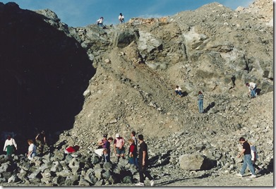
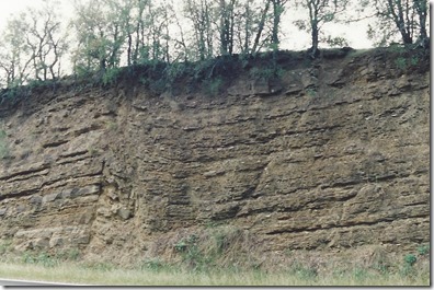
Now let’s fast forward 146 years to October 23, 1993 when I joined some of my fellow geology students on THE LLANO FIELD TRIP, The Evolution of Central Texas, led by our instructor Thomas Hobbs of the Geology Department of North Harris College.[2]

Clay near Plum
Hobbs collecting samples of Bentonite clay on the south side of Tx 71 at Plum, Tx. [3]


Pilot Knob is one of 75 late-Cretaceous Period volcanic complexes scattered around Central Texas from Waco to Austin, San Antonio, and Del Rio. Pilot Knob is just to the southeast of the Austin airport, easily seen from the tollway. All of these volcanoes have been extinct for millions of years.

Volcanic ash

McKinney Falls State Park. Basaltic lava flow from the Cretaceous volcano, Pilot Knob.

Reef beach rock
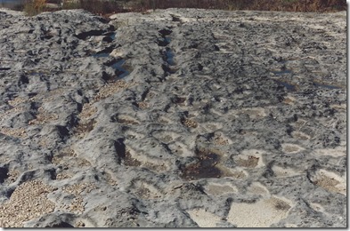
Reef beach rock formed when volcanic activity ceased at Pilot Knob. McKinney Falls.

Karst
Karst: Topography characterized by sinkholes, caves and underground drainage. McKinney Falls.

Enchanted rock
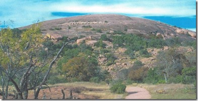
Enchanted Rock, elevation 1,825 feet, with a 360 degree panoramic view. The dome is part of a gigantic granite batholith that rose through the Packsaddle schist like a giant hot balloon about a billion years ago. It is now exfoliating (peeling away in thin layers).

Willow Ck. ophiolites
Willow Creek metamorphosed ophiolites that were pinched off the subducting ocean crust during the Grenville Orogeny. The crustal basalts were altered to produce low grade serpentine, talc and graphite.
Rock folding
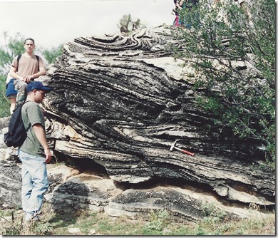
A breathtakingly beautiful example of Grenville Orogeny folding and metamorphism. Stewart Ranch.

Graben fault
Road cut example of faulting and formation of a graben sliding down between the rock strata on both sides.

Inks Lake
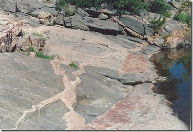
Pink gneiss in granite. Inks Lake State Park. The pink gneiss originated from fine-grained rocks that formed large and small dikes and fissures in the granite under great heat and pressure that changed the two different rocks into metamorphic rocks.

Lake LBJ overlook
Sauk sequence rocks at the Lake LBJ overlook. Note the layer with green glauconite with limestone clasts. A mineral of marine origin used in the textile, sugar, brewing and fertilizer industries.  Its the layer just about ten feet over the roadway.

And now we jump 25 years to the present day when the earth’s movement continues to make it felt in our area.[4]

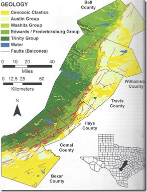
Hays' Geology

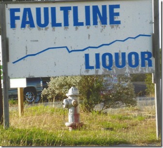
Note all the Balcones fault lines in Hays County. They are shown as disconnected red lihes. We are all familiar with the fault line that extends across Wonder World Dr. near the intersection of Old Ranch Rd. 12 as it is thrusting up again and the road is in need of repair. This fault extends to the Crestwood Strip mall on RR12 toward town where Faultline Liquor was once located.

Faultline Liquor

Another fault in the vicinity is the one near the entrance to the Baptist Academy on RR12. This section of road was repaired recently, but will need repair again in the future because the ground keeps shifting.
Although we may envy those who live on the Blackland Prairie east of I 35 because they have a lot of real soil, we here in BWR in the limestone hills with a little of that black land prairie dirt makes for a salubrious situation. And dirt wise, it is better than the calcareous soil over Wimberley way.

Sightings

10-13-18. Two brightly colored male blue birds on the garden fence right back of the house. We observed them on two different days. We’ve seen and heard a few of the phoebes.

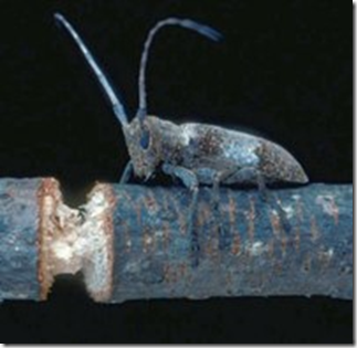
This is the first year we have experienced the Twig Girdler[5] bug. This very unusual bug cuts right around a tree branch that is about the size of a wooden pencil, completely severing the branch. The bug prefers certain trees, among which are pecan and cedar elm. Here is a photo of the bug just after it has nearly finished its work.

cut bug


Books

Books Nov. 2018


R & D Tusch


[1] From The Geology of Texas Vol. 1, Sellards, Adkins and Plummer. Also see the colored map: the mostly green section and east to the lower coast.
[2] Now called Lone Star College.
[3] The clay can be used both externally and internally and is sold online by Target & Walmart. It usually forms from weathering ash most often in the presence of water. See: Pilot Knob in Roadside Geology of Texas.
[4] Map from Karst of the Urban Corridor by Kevin Stafford.
[5] www.ocws.okstate.edu


Wow! 2024 A year of change

 Looking back over my notes of what happened with the vegetation this year brought back memories of how much of a shift we have seen from pa...