Monday, June 15, 2020

Keeping Time

 Stephen Hawkins wrote an interesting book titled “A Brief History of Time”.  So as not to be confusing, this newsletter will be called “ A Brief History of Time Keeping. And then, because so much of the history of time keeping is visibly on display at the Southwest Museum of Clocks and Watches, located in Lockhart, the newsletter will end by providing a brief tour of the museum.[1]

Before we get to the Museum, it is interesting to know more about the history of keeping track of time.

Various devices have been used to measure and keep track of time. The current system of dividing up the day into twenty-four segments dates to the Sumerians about 4000 years ago.

During this era, the middle eastern people used large obelisks to track the movement of the sun along with other devices to measure time.  Most of these were the water outflow type, along the same principle as the sand flowing through an hourglass.  The use of the obelisk was the idea that generated the sundial, the nifty garden decoration with the brass plate and the slanted gnomon.  The gnomon is a Latin word that means the pointer of a sundial.  Beware of sundials with gnomons at an odd angle, as sundials are only reasonably accurate when the gnomon is aligned with the Earth’s axis.

None of these ancient devices for keeping track of time were called clocks----that word came with the development of the mechanical clock, and one that could ring a bell.  In Medieval times, the word used was clocca which is translated into the English word of clock.  There are other spellings depending on the language, but they all are phonetically similar. Examples would be clokke, clocke, cloque, etc.  Another word that comes into our vocabulary is horology, stemming from the Latin word horologium[dt1] .  We will run into that word a bit later.

One invention that made mechanical clocks possible was the escapement wheel mechanism. The whole idea of the escapement made possible a clock that could display time on its face, by regulating the rotation of a shaft fitted with gears.  Escapements are a study unto themselves.  The principle of the escapement is shown by this schematic display:

Figure 30.1  basic escapement mechanism

The gray pendulum swings back and forth alternately releasing a gear tooth on one side and engaging a tooth on the other side.  Thus, with the swing of the pendulum, the shaft (black dot in the center of the toothed wheel) could be turned at regulated speed. The tic toc of old clocks is the escapement mechanism in operation.  Yet needed was a way to adjust the rate of this tic toc operation.  This was accomplished by use of a balance wheel and spring, or with the center of mass of a pendulum.  Either of these gave the first mechanical clocks their ability to be calibrated accurately with a measured beat.  Then, there is the need for power to make all this run.   Waterpower was used early, but metal springs able to be “wound up” and weights on chains are what made the early clocks suitable for use in homes and buildings possible in the 1600s.

Ever striving for accuracy, the pendulum clock was the most accurate up until the 1930s when quartz crystal oscillators were invented. But then, with the atomic age came the atomic clock based on the oscillating frequency of the Cesium atom referenced to zero degrees Kelvin.  The atomic clock is an extremely accurate time standard, providing clock time around the whole world.  The Cesium clock in Colorado provides an output that can be seen at https://time.gov/.  Today, this time is called Coordinated Universal Time across the entire world.

Accurate time is so commonplace now that few of us think about how precise time plays a role in our lives.  All nations are tuned into the atomic based clock now, but a few hundred years ago, coordinating time between places on the globe was a big challenge, especially when accurate time was needed to determine positions on the sea with a sextant.  There was a time not many decades ago that it was not only difficult to keep accurate time on land,  but also have the device transportable for use  at sea.  The only portable clocks way back then were more than a few cubic feet in size and very vulnerable to weather conditions.  Navigation at sea or on land was highly dependent on the accuracy of the clock.  Mapping, GPS location, transportation control, even the theory of relativity depends on accurate time.

Europe has an interesting history of clocks in public settings, all using old methods of keeping time and all having interesting features beyond telling the time of day.

We took the following picture when we were in Rouen, France in 1981. 

Figure 30.2  The Gros Horloge

The Gros Horloge is an astronomical clock with mechanisms and dials for indicating various astronomical phenomena such as phases of the moon and movement of the planets.  The mechanism is one of the oldest in France having been begun by Jourdain del Leche and completed by Jean de Felain in 1389 who became the first governor of the clock.  It is installed in a Renaissance arch crossing the Rue Gros-Horloge and in 1527 was moved from its original installation in the belfry to its present position so the citizens of Rouen could better see their most popular monument. 

Remembering the beauty and great age of the clock, another question remained to be answered.  Edge was asked, “What is the oldest astronomical clock in the world?”  Built in 1410 the Prague Clock has been keeping time for over 610 years.  The Gros Horloge appears to be older, but a little more digging uncovered the fact that even though it is in excellent condition, it has been powered by electricity since the 1920s., whereas the Prague clock is still keeping time with its original weights, gears, and teeth.  It is also composed of more moving parts, including statues.

Figure 30.3  The Prague Clock

Mounted on the south side of the Old Town Hall in the Old Town Square of the city of Prague the following features can be noted:  the Astronomical Dial that focuses on and records the universe of the Earth and Sun, the Zodiacal Ring that constantly moves the signs of the zodiac.  The third and fourth features bring into play moving sculptures.  The third feature is a portrayal of life and death and the sins that are to be avoided. When the skeleton rings a bell three figures shake their heads; they are not ready to die.   


              Figure 30.4  The Skeleton and Vanity


Figure 30.5  The Usury and Lust

Vanity tries to impress Death with his beauty, the Usury tries to buy him off with a sack of gold and Lust tries to entertain him.  When they rotate offstage, the twelve apostles begin to move in front of two windows at the top of the structure and when the rooster appears, the show is over until the next time.  A marvelous piece of engineering for the times.

All of this and more is featured in the Museum of Clocks and Watches, located in  Lockhart, Texas on the Square facing the historic Caldwell County Courthouse.  Built in 1894 in the popular Second Empire style of “Muldoon Blue” sandstone from Fayette, County, the courthouse’s mansard roofs and high central clock tower dominate the Square in French traditional grandeur.

Figure 30.6  Caldwell County Courthouse

And because of this special refurbished courthouse and its clock tower it began to have a special appeal to one man in particular, Mr. Gene Galbraith.  .  Gene was a music teacher and chorale director until he retired in 1991.  Always interested in watches and clocks, he apprenticed with McGuire’s Clocks in Austin for five years then went to work at Old Timer Clocks in Austin.  He became an expert well known and respected horologist and was Vice-President of Southwestern Chapter of the National Association of Watch and Clock Collectors when the idea of a museum came to him.  One night (all brilliant thinking comes at night) he envisioned a museum to be a repository for clocks and watches that would preserve history and provide a learning opportunity for young people.  The museum was formed in 2007 and after much organization, recruiting members, and finding donors, took up its first residence in September of that year in the Brock Building.  Built just 4 years after the courthouse in 1898, its corner entrance proclaimed it the original home of the Lockhart National Bank.  

The museum is ranked high among clock and watch museums of the entire USA. It has been featured in many publications and is well known throughout the community of clocks and watches experts.

Figure 30.7 The first location of the Southwest Museum of Clocks & Watches in Lockhart

Because the museum proved to be so popular and received so many excellent donations and loans of clocks and watches, it wasn’t too long before larger accommodations were needed.  Just down the street at 109 the old JC Penney building became available.


 Figure 30.8  Now at 109 E. San Antonio Street

This beautiful old building with its newly added interior galleries has the space to highlight the clocks of England, Germany, France, and America.

Figure 30.10  Entrance to the museum

Just to the left of the entrance is the lovely little museum shop full of interesting donated watch and clock items for sale.


Figure 30.11  Inside of two of the many galleries


Figure 30.12  Galbraith with The Great Clock Organ

One of the highlights of the museum, The Great Clock Organ stands 9’2” tall and was hand crafted of flame and burl mahogany in 1850’s Empire style. The organ has 72 wooden flute pipes and a weight-driven  bellows supplies air to lambskin valves.  The sliding wood cylinder has a choice of 10 different refrains that play as it rotates independently from the clock.  The statues you can see behind the glass, move when the music plays and this  amazing piece of furniture also  includes a desk with drawers for supplies.

Gene operates the museum with his associates, but those dedicated people do more than docent work in the museum.  One cornerstone effort is the restoration of the classic clocks of the county courthouses.  Gene is the go-to man for this restoration work---but it takes money to restore these old clocks to a condition where they will run for a long time.   Counties where clocks are needing  repair first have to appropriate the funds and then Gene’s team goes to work

These clocks  are the ones that are located high in the tower at many courthouses---many of which stopped operating because of lack of maintenance, but the interest in these magnificent clocks, as the classic county courthouses are being restored,  has placed a call on Gene to get them back into running order. Most of these clocks that have stopped keeping time have failed due to lack of maintenance and harsh conditions in the tower.

The classic courthouse clock has a face on four sides, so the clock not only needs to keep accurate time,  but must operate mechanisms to activate the minute and hourly hands, plus strike a bell on the hour---and manage the hands on all four sides of the clock tower.

At last count, Texas has some 50 county courthouses with tower clocks.  When we lived in Bandera County for a time we were impressed with the rehabilitation of the outside of its courthouse, but we were disappointed in the tower clock because it never showed the correct time.  Only recently did we learn that the hour and minute hands (that show 4:08) are painted on the clock faces.   The person who did the painting of the clock faces must have been an expert in trompe l’oeil because they look extremely realistic.

The Cooke County Commissioners in Gainesville, Texas .asked the museum to assess the condition of their Courthouse Clock as part of the courthouse’s restoration project.  It was found to be in  poor condition and needed a complete restoration.  Late in 2010 the museum’s proposal was approved by the Texas Historical Commission. The giant clock was installed in pieces in the early 1900s by hoisting the components up to the clock tower.  Now to repair it, Gene and his crew had to disassemble the clock and use a block and tackle to lower each of the components down seven stories-- a two-day job. After many hours of rebuilding and refurbishing this old clock, it was now in a restored condition and put on display in the museum until it was ready to be re-installed in the tower in time for the November 2012 rededication and 100- year anniversary of the courthouse.


Figure 30.13  Gene working on the Cooke County clock

In this photo of Gene at work with the E. Howard Clock in the tower at Gainesville in Cooke County, follow with your eye the vertical shaft which is turned by the clock mechanism.  This vertical shaft runs a set of gears which transforms the rotation of the vertical shaft into the rotation of four horizontal shafts, one for each of the four sides of the clock face.

Figure 30.14  Cooke County Courthouse

The clock is keeping perfect time today as it reigns supreme over the restored Beaux Arts-style courthouse with some Prairie features of Louis Sullivan seen in the ornamental plaster and stained glass.  Another historical Texas monument saved for the future by the citizens of Texas.

_____________Sightings______________

No quail, and not much new to report except we did spot some colorful creatures (homo sapiens) floating on the Guadalupe River at Horseshoe Bend in Canyon the other day.


[1] Open on Saturdays 10 AM-4PM or by appointment by calling (512) 658-3853.  Admission is free, and donations are gladly accepted.


 [dt1]

Friday, May 15, 2020

The Bastrop Fire 2011

Prior to 2011, there was a large area of Loblolly Pines growing in an unlikely spot in Central Texas.  Unlikely because in travelling from the vast forests of east Texas and Louisiana  westward, one finds miles and miles of rolling prairie until just before entering the Hill Country where there are these large, towering pines.  Centuries old, this pine forest is called The Lost Pines. The “lost” name was applied because this forest was a remnant, disjunct section of pines that was separated from their species in East Texas by about 100 miles. This 100,000-acre forest became disconnected from the same species of tree of the well- known Piney Woods of East Texas during the most recent glacial period of the Pleistocene era.  Interestingly, from the botanical detail of the two stands of Loblolly Pine, it may be that the Piney Woods tree is an offshoot survivor of the Lost Pines trees.  That might be true, but what is evident is that the soil is key to the existence of these pines in the Bastrop area.  The soil is red sandstone, and the pines liked it such that they stayed after the last glacial age ended.  Some recent studies show, however, that the Bastrop pines are slowly giving up their residency in this area of Texas.  Left alone, they may slowly disappear in another couple thousand years.

Early botanists noticed this pine forest as unusual. It was mentioned nearly 174 years ago in June of 1846 by Ferdinand Roemer[1] as he and a friend were travelling from LaGrange to Bastrop.  As he approached the area, he noted the sandy, gravelly soil with pieces of petrified wood,  and made note of the Loblolly Pine and Post Oaks.  To quote from his journal: “Just opposite La Grange, the peculiar sterile, salacious soil appeared red in which in addition to red rubble stones, larger and smaller pieces of silicified wood occurred very frequently.  Only post oak (Quercus obtusiloba) and yellow pine (Pinus taeda L.) grow on the long stretches of gravel and sand of Central Texas.

Both species of trees have the peculiarity of excluding all other trees where they grow whereas other deciduous forests of North America are composed of a variety of trees.

In distinct contrast, to the prevailing uniformity of the vegetation and sterility of the soil, stood the forested bottoms of  several brooks flowing into the Colorado River through which our way led.  In this deep black soil, the bottom vegetation grew as luxuriantly as is the case along the larger rivers such as the Brazos. The huge Poplar trees on which the grapes and other vines climbed, were again conspicuous.”

Logging of these big pines in the 1800s reduced the population of trees by about ten percent for the wood required to build homes and commercial buildings. Then, a large area was protected by the two state parks established nearly a hundred years ago. Bastrop State Park and Buescher State Park have always been popular places for recreation.

Fires have always been a threat in pine forests and that came into play when on an extremely hot and windy day, the sparks from a downed power line in two locations ignited the brush and tree debris and an out-of-control ground fire was started.  Quickly, the ground fire became hot enough and so intense that the fire got up into the treetops and began to consume the whole area. The fire of September and October 2011 lasted for weeks and threatened the whole area.


To understand how this fire went from a ground fire to a forest destroying fire, it’s important to understand pine rosin.  Normally, fire control experts who manage controlled burns will easily agree that pines of this size, some of them 2 feet in diameter, can withstand intense fire around their base.  But, let that fire get into dense underbrush and grow to such a size that it reaches the green needles of the tops of the pines and its sure death to the tree.

We experienced this problem with Ashe Juniper in Bandera County when a fire got out of control some miles south of our property and burned a swath for miles before being extinguished.  The risk of a small fire getting out of control depends on heat and dryness.  When the foliage of evergreens such as juniper or these Loblolly Pines experience ambient temperatures above about 110 degrees F, the rosin in the needles can burst into flames from even the smallest ignition sources.  That was the problem in Bandera and it appears the same risk factor situation that existed in the Bastrop area when this fire got out of control.  That is, the fire reached into the needle foliage of the upper part of the tree and then raced from tree to tree until it essentially ran out of trees.

34,000 acres, nearly half of this grand old forest in Bastrop County, were ruined; 1,660 homes were destroyed; 2 people perished and 12 were injured.  Both state parks were damaged.  That was 9 years ago, and the appearance of the area still shows what a terror this fire must have been.

Figure 28.1 Burned area. (NASA photo marked)

At first, the speculation was that carelessly tended open fires were the cause of the fire, but weeks later in probing the starting areas, it was concluded that in two places, power lines were broken by the wind and fell to ground causing sparks.  We always generate a lot of worry about pipeline hazards, but never worry about power line failures, but now that has changed.

The fire was observable for miles, traffic was detoured, and emergency crews arrived from all over the state and even from other states.

As is the case with all intense fires like this, the fire created its own windy condition, adding to the normal windy condition at the time.  This made firefighting difficult and  remarkably ineffective.

     Figure 28.2 Flames reached high

From Figure 28.2 it should seem obvious that the flames during the height of the fire were way above the tops of the trees, making it easy for the fire to run high off the ground consuming all the forest in its path.

                                        Figure 28.3  Aerial view of scorched area

Figure 28.3 is an aerial view of the burned swath through the forest. It was a very windy day and quite easy to imagine the wind-driven fire raging through this area.  The topography is not all flat as it looks on the right in the picture but is in many places hilly and cut with many ravines. In some areas of the burned part, there are towering hulks of the dead trees.   However, for most of the area, the trees that died have been cut down, and, we think used for good purposes, as the felled tree if not hauled away would be visible and they were not.

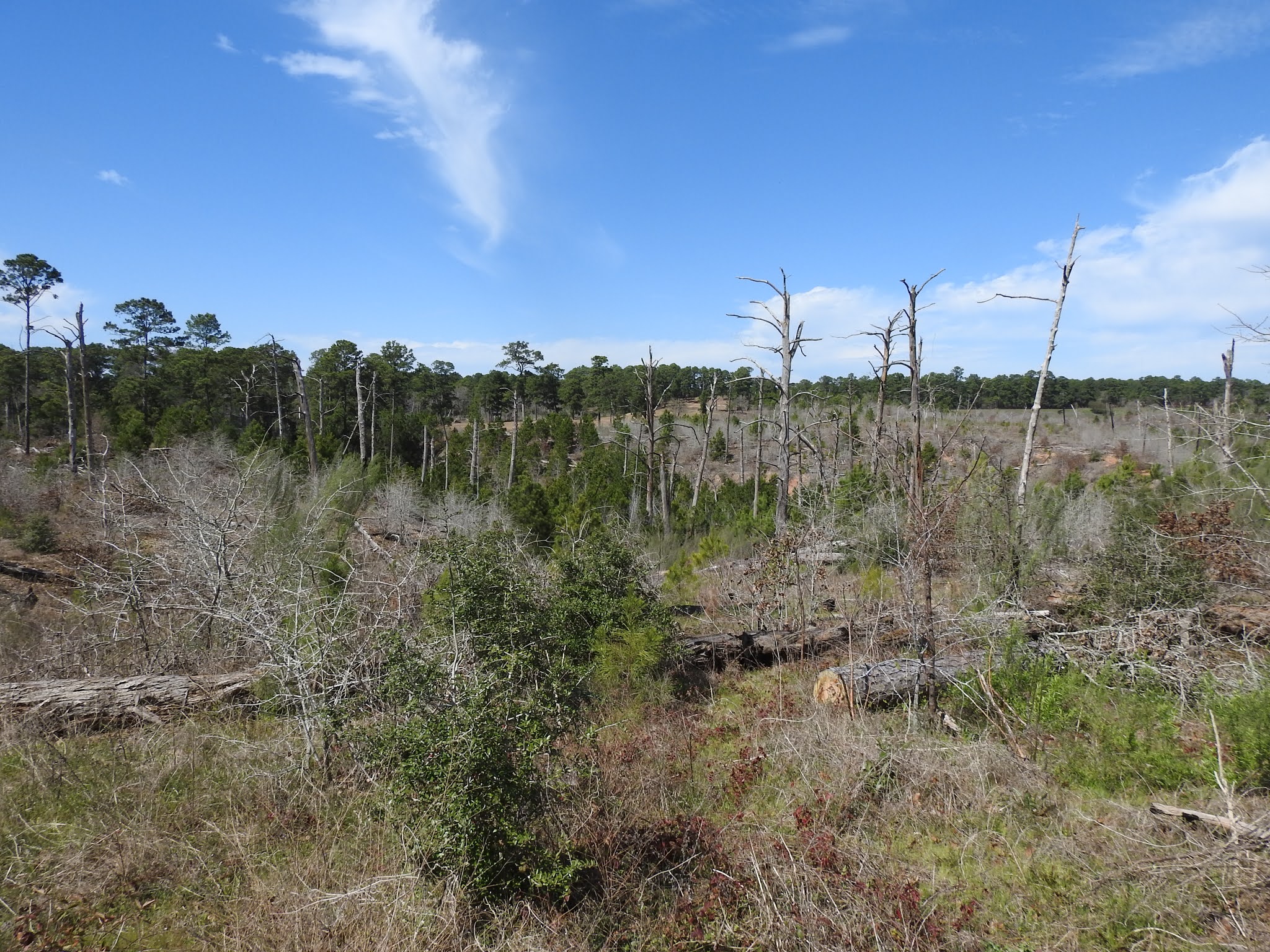
We visited the area this past winter to see how well the forest was recovering from the fire.  Here is what we found.

Figure 28.4 The first stop on our tour


It was also a warm day and the redolent breeze carried the fragrance of pine needles. In the distance under the new growth of replanted loblollies a rust-colored carpet of old needles could be seen.

Figure 28.5  New growth appearing


Figure 28.6  Example of the Loblolly Pine bark

Before moving on to see the rest of Bastrop Park, we we took Road 1B to check out the Pioneer Village Cabin Area.  The trees in this immediate area were not affected.  These cabins were all constructed and built by the CCC in the 1930s using the pine logs of the area.  Here is just one of about twenty cabins in this village and several of them were occupied on the day of our visit.  The tree at the left of the cabin is typical of the mature trees in this forest. 

                            Figure 28.7  CCC built cabin in Bastrop Park

    Figure 28.8 Much of the forest didn’t survive

There are still grim reminders of the devastation and visitors are warned to stay away from standing dead trees because they may topple over.  Continuing on Road 1A on our way to the Overlook, we noticed a few spots of what looked like possible prescribed fires along the sides of the roads. 

In an unrelated incident to the fire, that same year on Memorial Day, heavy rains caused the already full Bastrop State Park 10 acre lake dam to fail and the flooded Copperas Creek surged down the ravine on a wild tear to the Colorado River.  Its waters damaged roads, trails and the golf course.  The Texas State Legislature has appropriated 8.4 million dollars for repairs but it is all taking time.  Arriving at the overlook situated on a prominent knob, we took pictures across the ravine shown in the foreground of Figures 9 and 10.   The ten-acre lake once filled this ravine.  Presently there is no water.  

Figure 28.9  Barracks with the telephoto lens.

Figure 28.9 also shows new pine growth that is emerging all over the burned area.  The appearance of the new pine growth shows that seedlings began to emerge right after the fire, because most of the young pines are 8 years old based on their growth sections. There is some on-purpose reforestation occurring in certain areas.

Figure 28.10  Barracks and other buildings with the regular lens.

It will be interesting to observe how this area recovers in the next twenty years because there appears to be competition from the hardwoods.  For this pine forest to recover to its original condition, the pines will have to dominate the hardwoods and even drive them out.  Presently the score is even in most of the recovering areas.

The Bastrop County Complex Fire was the most devastating wildfire in Texas’ history and in searching the Internet for ideas to prevent recurring fires, we came upon an article by FEMA that outlined some steps to protect residents.  One action the county is taking, according to Mike Fisher, Bastrop County’s Office of Emergency Management Coordinator, is fuel reduction.  Ridding the understory of dead trees, fallen trees and unwanted understory growth by mulching as opposed to prescribed burning is nontraditional and labor intensive, but Fisher says it’s one that‘s unique and not   been used before as far as he can tell.

 The county received a grant from FEMA’s Hazard Mitigation Grant Program (HMGP) to fund the program.  Almost 4,000 acres were targeted and placed into north and south zones.  The zones were studied to determine where large tracts of wild land (with a history of destructive fires and high- density understory fuel) met smaller tracts of developed land and subdivisions or houses located on small, medium and large lots (with varying degrees of fire resistivity and defensible space).  FEMA contributed over $1.2 million of the $1.6 million cost of the north project and $1.6 million of the $2.1 million cost of the south project .  The HMGP grant had a two-year performance period.  Four skid steer tractors were purchased with these grant funds and will be used to clear the understory.  Also, another idea to clear 1000 feet each side of 1441 was proposed. 

Using the skid steers, low-impact machines with a mulching head on the front, the county designed a mechanical thinning process.  Operators grind up the understory and remove undesirable tree species growing under the tree canopy.  On a wildfire outbreak the fire stays on the ground and does not go into the trees.


 Figure 28.11 Skid Steer Mulching Equipment

Fisher found few skilled contractors available to work the machines so county employees learned how to operate the equipment and will proceed with the task of clearing.

The project sparked excitement, curiosity, and some reservations among residents in most of the private acreage targeted for mitigation.  Fisher found “getting the residents buy-in the most challenging part of the project,” but “believes what the county is doing is a good measure to take.”


To get another professional opinion on what has happened since 2011, we contacted Kari Hines, Firewise Coordinator Mitigation and Prevention Department Texas A & M Forest Service in LaGrange.  Kari said that in late 2015 or early 2016 was when the crews began the mulching project and the first phase was accomplished in Tahitian Village.  There were two human-caused fires in 2016, that she knew about, in areas that were treated that the local fire department was able to put out more quickly and safely because of the work that was done.  Work was done almost completely on private property, with the agreement signed by the landowners that they would be responsible for maintaining the low fuel condition after the work was done.  Future phases of this work included mulching on the Boy Scout Camp and private property along 1441 and further south, in and around some developed neighborhoods between Bastrop and Rosanky.  Today, one can see in Tahitian Village and on 1441 which owners allowed mulching, and which didn’t by the density of the understory vegetation.  Depending on maintenance, the yaupon has grown back quite well in some areas.  Owners could decide how the mulching was to be carried out so there is often a mosaic pattern to the work completed on their properties.

Kari went on to describe other efforts on public lands by Texas Parks and Wildlife, Texas A&M Forest Service, Texas Military Division (Camp Swift) and other large- scale landowners including and expanding their forest floor fuel reduction projects.  These were projects that had been in place before the 2011 fire and were accomplished by hand with chain saws, mulching equipment, or prescribed fire.  The Bastrop Complex showed land managers how important  proper land management is as it was obvious that stands of trees that had prescribed fire in Bastrop State Park had much less severe damage than adjacent stands where prescribed fire had not been applied in years.

With our membership in Firewise we are reminded of the dangers of the growth of ladder fuels around our homes.  Our website features a Firewise newsletter on the effectiveness of fire damage prevention.  To maintain our rating of a Firewise Community, we complete a report annually and submit it to the Forest Service.  So, when you are out and about, survey your property, especially the area close to buildings and if you do any clearing on your property that can’t be seen from the road, please let us know so we can include it in the report.


                   ____________Sightings

§   This month the main sighting has been rain.  Wiley’s data posted on the website from his official rain gauge showed that we received 4.5 inches on Tuesday the 12th. 

§    We have not seen the Poor Will nor the Cuckoo but have heard these two annual residents already.  These are two birds that are usually never seen but often heard calling.

§    What is somewhat disappointing is that we have heard nothing of the Bobwhite Quail.  We hope that someone has heard them indicating that these birds are still here.   There is no telling what damage to wildlife and plant life has occurred because of the drought of last summer.


R &D Tusch


[1] Roemer’s Texas 1845-1847 by Dr. Ferdinand Roemer


Saturday, April 25, 2020

Old Roads


Everyone, well, almost everyone, has a story to tell.  We haven’t  encountered any person who wasn’t willing to tell their story of some past time.  Every place has a story to tell as well, but place stories are always generated by the person who was there. 

Of most importance is that the story of a place must be documented because if it is not, then at some time in the future it ceases to be a story and is lost forever.

Earlier, when we looked at the history of Hugo and the upper end of Purgatory Roads, we found a few items of historical significance, but knew at the time that we had not yet found most of what lies hidden  about the people and their activity on Hugo and Purgatory Roads.

Paper documents seem archaic today in this digital age, but digital files can be lost due to advances in technology. Take for example digital files we made on the old A drives.  These are not readily readable today because most people who had files on the old floppy discs tossed the discs away because they no longer had a reader.  I found that to be the case, so now I have an A drive reader.[1]  The next example is photography.  All of us take far more photos today than any time in the past, but are these photos being saved with labels?  If not saved with a label, either by hand or with metadata, they too will become lost.

So, the best way to preserve a record for general use in the distant future, is to write it out on paper.  Acid free, that is.

Recently we came across a paperback book in the Historical Museum in Seguin[2] that chronicled life along a road running from San Antonio to Seguin.  The book is filled with information about life in the farming community alongside this road and how that life changed with WW I & II and the industrialization of the whole area that followed these events.  It’s all on paper and all readily available.

In this area between Seguin and San Antonio a bit more than a hundred years ago, there were only two roads that linked San Antonio to the town of Seguin.  One was called the Upper Seguin Road and the other was called the Lower Seguin Road.  In early days, descriptive terms like these had more meaning to the residents along this road than highway numbers as used today.  After all, who else needed to know the name of the road other than the local people? So, for you to locate these roads today, they are FM 78 and County Road 312.  Plug those numbers into Google maps app on your phone and you find right where they are. However, that’s all you know about life along these two roads unless you read the book which a very thoughtful person wrote 20 years ago.

Roads carry a lot of history because many of our roads started out as animal trails.  We can see this easily right here in BWR as the longhorns and deer have made well- trodden trails across the ranch. And it was bison, deer and cattle that found the best routes across the countryside, followed by the Indians.  New settlers used the old trails and many of these became our early roads.


Both these Seguin to San Antonio roads had to cross running streams or dry creeks.  In the 1800s these roads had many dry crossings, fords or ferries depending on the presence of water.  Today, the Upper Road is continuous and is constructed to modern standards and  most of the local historical artifacts have been removed from  the roadside on the western end due to the needs of expansion in Schertz and Universal City.  But farther east, into the area of Marion and McQueeney, area history is still known by  the local people and some artifacts remain on upper road.

Along the Lower Road from San Antonio to Seguin, the road still exists, but because of such little demand for through travel, the road is interrupted at two places for lack of a suitable water crossing.


 Figure  27.1 Map showing Marion, McQueeney and Seguin.


If you zoom in on the map, you will see a secondary road parallel to  Hwy 78 and I-10.  That is Stagecoach Road. 

The two families in the book titled Stagecoach Road are  real people and as the author tells us, “they represent thousands that made their living as farmers on small farms in Texas primarily growing cotton in the early part of the 20th century.  They experienced the pleasures and hardships of farming along with numerous personal tragedies and triumphs in their lifetimes.  They were born into a unique culture and over time experienced an astounding array of technological advances and major worldwide events that dramatically altered their lifestyles.”

Because we were impressed with the story of Stagecoach Road and how detailed it is, we decided to search for any vestiges left of the places described in the book.  The first to be mentioned is the Sebastopol House, built in 1854, at 704 Zorn Street in Seguin.  Noted for its architecture and building material “limecrete”, it is one of only 20 structures left in the city that originally boasted over 90 limecrete buildings: houses, churches, even the courthouse and other public buildings.  It is now an historic site and may be toured. Years before the Civil War and before Portland cement was developed, Seguin was a center of concrete experimentation.  In the late 1840s, Dr. John Parks, who was also a chemist, moved here from Georgia and patented formulas for “limecrete” from local materials.  On-site caliche and gravel plus nearby sand and water from streams were mixed with traces of clay and ash.  To this mix was added Hill Country limestone made into lime by grinding and calcining, then hauled to the site from San Marcos.  Skilled West African slaves, who were master builders of this take-off on mud-type construction then monitored getting the proportions just right and took over the building process. 


Figure  27.2  Sebastopol House Historic Site.


We had already toured Sebastopol house a few years ago, so we headed first to the junction of Stagecoach Road (312) and FM 725.  On the map Stagecoach Road seems to cross over 725 but this extension that winds down to the Guadalupe River is known as Erskine Ferry Road.  Of course, we saw nothing like the ferry pictured in the book, but it was obviously the right place.  Except now a large house took up the space where Mr. Grimm had once plied the ferry across the river, let down the short gangplank for a buggy to pull onto the boat and its occupants to be ferried across to the opposite bank. 


Figure  27.3  Erskine Ferry site today.


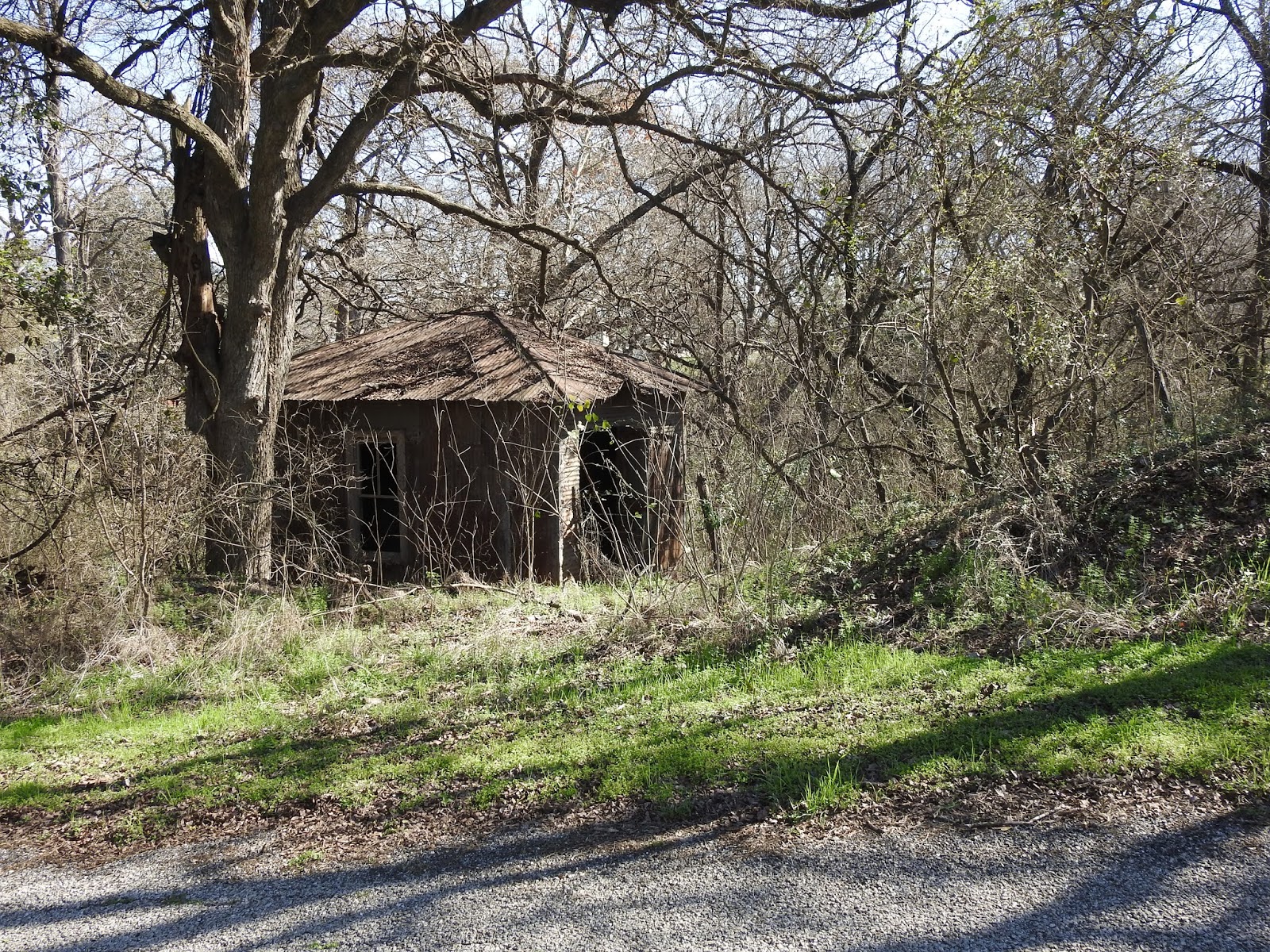
On our way back out Erskine Ferry Rd. we passed an old shack and took the following picture.  We found out later that it housed the two pumps that supplied Guadalupe River water to farmers in the area who signed up to be part of the ambitious water project begun by the author’s father in 1926.


Figure  27.4  The pump house for the water project.


The project’s members did almost all the work themselves including acquiring bank loans, ordering and installing the pumps, erecting the water tower and laying the pipe ten feet onto each member’s property.  From there each farmer laid pipe and installed faucets to the kitchen, barn, wherever they wanted to have a water supply.  No more carrying water from the cistern and now a way to alleviate some of the effects of the long drought.  Irrigation was to be limited to gardens and yard plants.

How did these small- town farmers know how to successfully accomplish engineering this water project?  They were members of a small community, most were on the same party[3] line, they knew each other well and were accustomed to working together and helping each other.  A lawyer friend told them how to set up an organization. The organization also had the help and advice of local bankers, a friend who had already set up a water system in McQueeney and in addition they got Alamo Iron Works of San Antonio involved.

They held meetings, wrote bylaws and elected a board. Farmers mortgaged their property, funded the Stagecoach Community Water System,  and became members.  A member who owned the land where the pump house was to be built, donated a 50-year land lease. They were in business and construction began.

Once activity began, members and other onlookers showed up to work or watch the progress.  Finally, the day arrived to open the faucets and flush the lines while a few housewives watched appalled as brown water gushed forth.  Reassured that it would clear, they soon saw clear Guadalupe River water take its place.

Unfortunately, nothing remains of this great community effort except for the pumphouse, the underground piping and probably a few foundations covered over with vegetation.


Figure 27.5 Pumphouse foundation


Figure  27.6  Rusted remains of a buried pipe


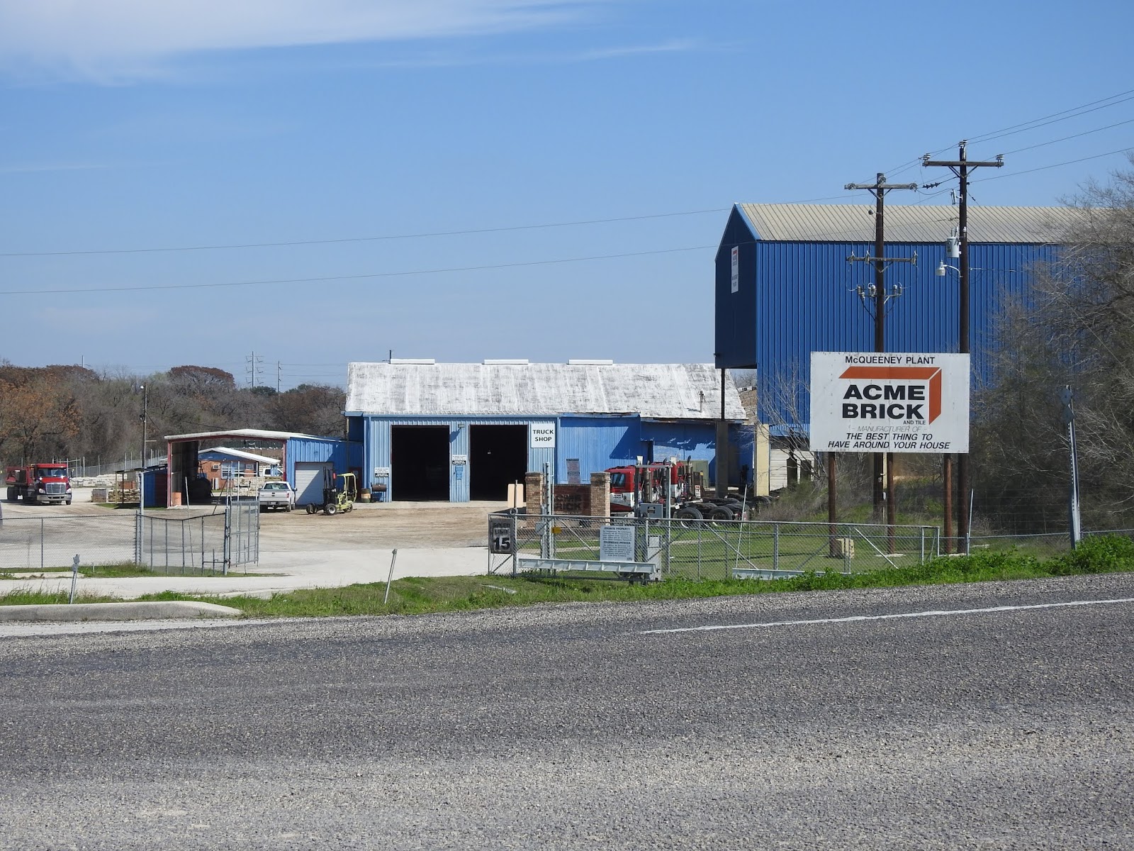
Back in the car, we returned to Hwy 725, turned right and traveled a short way until we saw Acme Brick on our right.  The site of the clay pits and brick company has had many owners and is over 100 years old.  The book author’s father worked here during the drought years to add to the farm’s income.  And it was here in 1929 that he lost his life in a tragic accident at the age of 39.


Figure  27.7  Acme Brick McQueeney Plant on 725.


The plant no longer makes brick and tile as, we were told, the clay is much more accessible in Kingsbury, and the bricks are made in the large modern plant in Sealy.  Some are hauled here for local sales, but it is mostly used as a truck depot and repair garage. A man on duty at the office showed us a brick with a Seguin imprint that was made back when the plant was the Seguin Brick Company.  He then told us about a seam of blue clay discovered at this site that was found to be loaded with fossilized sharks’ teeth.

We returned to Stagecoach Road and with the telephoto lens took a couple of pictures of old barns.  Surrounded now by mesquite trees they are left on the properties once owned by the author’s father and grandfather. 


Figure  27.8  Old barn on Stagecoach Road


Figure  27.9  Collapsed outbuilding on Stagecoach Road.


Figure  27.10  Site of the school the author attended.


The school was quite close to the author’s home when he lived on Stagecoach Road. There are very few traditional farmhouses with fields left on the road.  And when we were there in early fall, the crops that had been planted in the fields that were still producing were not cotton, but field corn grown for animals. And, the new dwellers along this road have no knowledge of the activity here 100 years ago.

Next on our agenda was to visit the town of Marion. Back in the early part of the twentieth century it was a bustling town. Today, the activity in the town is less than in the past but it still has all the businesses for local needs.  A prominent feature of the town is the huge hardware store that can supply just about anything a fellow would need.


Figure  27.11  The General Merchandise store and bank building in Marion, Texas, ca. 1920s.
  

This is where the local farm families came for repair parts, tools, building materials, pots, pans, buckets, plumbing supplies, you name it.  They could ship their cotton and pick up orders shipped to them from San Antonio and beyond. Also, over 100 years old, the General Merchandise store is still there but now with a franchise name: Helping Hands Hardware.


Figure 27.12  Hardware store Marion present day


The exterior may look a bit different, but the interior looks much like it must have looked in the old days.  The inventory is incredible and rises from the well- preserved wooden floor all the way to the ceiling on neatly stacked shelves.


Figure 27.13  Inside of Helping Hands Hardware


Note the old wooden ladder on rollers to access the upper shelves.


In Figure 7.11 you can see that cars were beginning to replace horses and even the train as a means of transportation.  And the thrifty farmers became mechanics in many instances and learned to repair their own equipment using books and magazines to help them.


Figure  27.14  Ad in a Popular Mechanics magazine.


Tires in those days were often victims of rough gravel roads and in one of the book’s narrated incidents, a problematic tie rod had to be dealt with.  One of the men sacrificed the tongue of his leather shoe to make a temporary sleeved bearing for his engine that served until the bearing could be replaced.


After Black Friday and the onset of the Depression, women joined men in looking for work in businesses and factories in towns and cities.  While families on farms turned to new ways to augment their living from crops.


Figure  27.15  Ad in a Popular Mechanics magazine.


Having become a widow, the author’s mother assessed her situation and decided to lease her home and farm to tenants and focus on her children’s education.  She used her husband’s insurance money, brickyard settlement and workmen’s compensation to pay off most of the farm’s debts and build a smaller mini farm on almost three and a half acres on Zipp Avenue in McQueeney.  The children would be closer to their new school and they would continue to raise chickens, cows and pigs and sell eggs, milk and butter.  Just up the street lived her sister and her husband; her youngest sister would be moving with her.

Recently, we searched for this house built in 1930 and found it on Zipp Avenue.


        Figure  27.16  The house on Zipp Avenue


               Figure  27.17  house on Zipp Avenue 2020.


The house appears to have changed very little over the last 90 years.

With the discovery of this house, we had come to the last of the known existing effects of three generations of the people featured in Stagecoach Road. And while we were still thinking about lower roads in general, we decided to revisit via, Google Earth, the lower road we grew up on in Michigan.

Known as the Lower Ada Road by the old folks, Carl Drive, a gravel road peeled off from M 21, went downhill a short distance and hooked up with Grand River Drive another gravel road.  The road paralleled Grand River, unseen behind the hills, on its way to Ada.  We put R’s old house number 5870 Grand River Drive in Google Earth search box and were whisked to another enclave of three generations. Across the road lived his grandmother and next to her his Aunt Mae and cousin, JoAnn.  And in 1946 Dee’s family moved next door on two acres.

Now the gravel road is paved and there’s even a sidewalk.  Behind his relatives’ homes was his grandparents’ vineyard.  The vines produced table grapes to sell in Grand Rapids and wine grapes for neighbor, Tommy Pugliesi.  The vineyard was also where R’s grandfather found a large stone Indian tool and his uncle uncovered a copper spearhead.  All the people living in subdivisions along this ridge of land today probably have no idea what was here in the past.  They won’t know that Mr. Martin let us kids play on his tennis court, range all over the pine forest he planted. and skate on his pond.  And, Mr. Sarret let us make a ball diamond on his property on Alta Dale Drive.  Then still on Alta Dale but over M- 21 we fished and swam in Mikucki’s creek.  No one ever questioned our presence so we assumed it was okay to share the field with the cows.  We know what houses were present in the 1940s and have pictures of most of them and remember who lived in them.   But the schoolhouse that used to sit on the corner of Carl Dr. and Grand River Dr. has been moved into Ada and serves as a Country Store.  None of us who lived there at the time live there today to pass on what existed in the 1940s.  Looks like a good opportunity for another book.  This one to be titled This Old Road.

______Sightings

Here is a “never before” for us: 

Several of these snake-like “things” were spotted on the driveway this last week. From six feet away, it looked like a slow- moving snake with no discernable head. Close inspection showed it to be a well- organized troupe of bugs. We saw something new, at least new to us.


Figure 7.17 Fungus Gnat Larvae


 R &D Tusch


[1] All may borrow it should you need to use one.
[2] Stagecoach Road (Revisited) by Dalton Elley- 2002 revised by Steve Mardock – 2017.  Available at the Wimberley Library in the Book Club Section.
[3] A telephone party line, meaning that it was shared with neighbors with each member having a unique ring.

Wow! 2024 A year of change

 Looking back over my notes of what happened with the vegetation this year brought back memories of how much of a shift we have seen from pa...