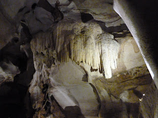
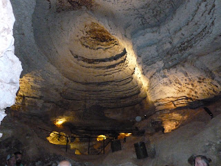
Rain produces interesting effects. From rain comes
springs, sinks and caves, all due to the action of water. This newsletter will focus on these three
effects, all observable in our area.
Hays County has about a dozen springs that have a
significant flow. Most flow year round,
but some go dry during periods of drought.
When you think of a spring, think about its source of water, a rather
large pool of water contained in the underground karst formation, mostly
limestone. The recharge of this pool of
water is, of course, rain. Someone has
probably made the calculation about the capacity of this pool of water that
feeds the springs, but we can assume that it is very large, like trillions of
gallons. Of our 35 inches of rain per
year, maybe a inch or less of these 35 inches make it into the pool. Pumping,
evaporation, runoff, and plant usage take the rest. So, protecting the areas (the recharge zone)
where rain can enter the pool is important.
The San Marcos Spring(s) are plural
because the water that flows into Spring Lake comes from many springs in the
immediate area, most of which are on the bottom of Spring Lake. The area around the springs was a gathering
place for humans for thousands of years.
We came close to destroying the beauty of it during the last century
with all the entertainment focused in the area. The blind salamander, and other
rare and unusual plant and animal life are found in the water. Downstream of the lake one can see Texas Wild
Rice, only found here in the river. The
major protector of the river and its water source is the San Marcos River
Foundation.
Jacob’s Well is located northwest of the center of Wimberley in
the Woodcreek area. It now is owned by
Hays County along with a substantial holding of surrounding land that is
designated as a Natural Area. Before
Hays County began to organize and control the usage, the usage by swimmers was
high, but now the access is more difficult and the recreational use of the
water has been reduced to a manageable level.
Jacob’s Well is a circular hole about 10 feet in diameter and some 120
feet deep. Many years ago, it was a
favorite place to dive into the depths, but there were fatalities and that
usage has been stopped. Sometimes when
you visit the well, the flow is so strong up and out of the hole that a person
would have difficulty swimming down into it.
On a recent visit, the water flow was very much reduced, probably due to
our current lack of rain.
Note: It’s an easy walk back to the well until you
come to a steep set of stairs toward the end where I waited for R to check out
the rest of the route. There is a hand
rail on the stairs and I had my cane which made a pretty good walking stick,
but from there on the trail was over rock which fell away to the right with a
steep drop to the creek. I had seen the
well before when its access was much easier from the other side and decided to
pass on it.
In addition, it’s worth mentioning that the county has
added a bird viewing blind and in the prairie area they are planting native
grasses. We were there soon after they
opened at 8 am on a Sunday and had the main trail pretty much to ourselves until we neared the
parking lot on the way back.
Also in the Wimberley area is the Blue Hole. This is a large pool of water with good
spring flow. It is considered to be a
tributary of Cypress Creek that flows through the center of Wimberley. The flow of this spring is strong at about
50 gallons per second. The Blue Hole
needs this strong spring flow as it is heavily used in the summer months as a
place to swim. Get there early in the
day if you want to get into the park. Its access is limited.
Two other springs need recognition, one close by, the
other on remote property and a good flowing example of a spring. The one close to us is Purgatory Springs,
considered to be the source of Purgatory Creek.
Purgatory Creek is dry most of the year, but the water from Purgatory
Springs can be seen at the intersection of Hugo Road and Purgatory Road. Most of the springs are on the ranch across
Purgatory Road on the ranch, near the windmill that you see from the
intersection. Some other small flows
come from the ranches east of this intersection, like on the Stoepler Ranch,
the gate that you pass on Hugo Road between the
intersections of Summer Mountain
Dr. and Purgatory Rd. The pond as one
nears Purgatory is a good place to catch sight of ducks during their season of
migration. During the severe drought of
2011, the pond was nearly dry.
The other spring of the area is Bank Spring, also
known as Little Arkansas Spring. It
gushes from the high bank alongside the Blanco River at about 30 gallons per
second during periods of adequate rainfall, but seems to be very dependent on
local rainfall . This spring is located
in a remote area so it is hard to get in to view it.
In the Dripping Springs and Driftwood area there are
several noteworthy springs. They are
Walnut Springs, Dead Man’s Hole, Ben McCullough Spring, Rooster Springs, and
Capt Springs. We have not explored any
of these.
Sinking Streams, Sink Holes and Caves Sinking streams are places where flowing water
disappears into the ground. Of course
the most noteworthy sinking stream in the nation is the Humboldt where the
Humboldt River flows out onto this broad plain and then just disappears. That
is in northwest Nevada. In Texas, we have two flowing sinking rivers for sure;
one is the Frio River and the other is the Nueces River. Both are known to disappear in gravelly beds
only to reappear miles downstream at a much lower flow rate. Here in Hays County, we are not aware of any
sinks on flowing streams, but the number of sinks on dry creeks is about 600. These are sites where, during heavy rain
runoffs, the runoff water disappears into a sink hole. This is the water that feeds the pool of
water that provides flow to many of the springs. As you recall, there was a link to a running
water sink hole that was shown in the last newsletter. These sinks need to be protected because
developers have a tendency to fill them with concrete to make the land more
useable for development. Sink Creek, in
Hays County, suggests it’s a creek that sinks but we have not verified or
determined that. Below is a link to a
sink hole in Round Rock that exposed a cave this year in February. The event was apparently triggered by a water
main leak that eroded the ceiling of the cavern which then allowed the road to
collapse into the hole.
Use
Ctrl , then click to activate the link.
Another related underground cavity made the news in
Louisiana when an oil drilling rig was putting down a hole in an area known to
have underground salt deposits. These
underground salt deposits (there are many in the Gulf Coast area) are often
cavernous, that is they are not solid salt, but have large volumes of open
space. The oil rig was drilling a hole
in a brackish lake when the drill bit broke through into the roof of the salt
dome that was a salt mine. In a matter of a few hours, the lake drained itself
into the salt mine, and eleven barges went down the hole, now enlarged from
drill size to many feet across. After flow
from the lake filled the entire cavity,
water from the gulf filled the lake and then nine of the two barges
refloated back up through the hole.
Texas is a
cave-rich state. The area of the state where most of the caves are found is in
a band along the bottom of the state from the Balcones Fault all the way to El
Paso. This belt where caves are found extends beyond the western edge of Texas
as evidenced by Carlsbad Cavern.
All of this
karst, springs and cave investigation reminded me of the geology courses I took
at what was then NHCC at the south campus when we lived in Humble. Inks Lake and Longhorn Cavern were stops on a
class trip in that course. So,I planned
a trip for us to revisit that cave. We
left BWR at 8 am on August 9 and arrived at the old CCC- built (Civilian
Conservation Corps) State Park at 9:30 in plenty of time for the 10 am
tour. The cave is not the most stunning
in the state, but it is the longest and the only one formed by the action of a
river of water that dropped into a sink
and flowed underground for the last mile before joining the Colorado
River. Its mild acidity and erosive
action carved the cave rooms and corridors.
The tour took 1½ hours and we covered 1¼ miles. Not surprisingly, it took the CCC workers six
years back in the thirties to clean the debris left by the ancient river out of
the cavern. Working with low-powered
head lamps and hand tools they built wonderful state and national parks all
over the United States.
The cave was beautiful and I’m glad I went now as the walk over the uneven stone was a bit challenging even with my cane. However it was well worth the effort and it was lovely and cool in the cave!
Observations
and Sightings
On 8-07
around 6:30 pm one of those brief downpours came through and one of its outer
edges occurred right over the middle of our house. The sun was shining in the front yard and
only a few drops could be seen while in the backyard it was a torrent. This went on for several minutes before the
rain stopped and we saw no rainbow. R
looked up the weather and it was showing North/South vertical showers. We had never seen this curtain effect before
in such a dramatic divided situation.
The Painted
buntings have left us and the Purple finches have arrived. There are probably no more than a dozen very
small Eastern Pipestrelle bats in Longhorn Cavern and we saw about four
clinging to the rock. They are
non-social and do not hang together, literally and they fly in and out on their
own.
David F.
captured an image of a Gray Fox that paid his place a visit. A beautiful wild animal to say the least.
Texas Caves by Blair Pittman (1999) available at the Wimberley
Village Library. This book was very
interesting, but I was looking for a book with information closer to home.
I found Karst of the Urban Corridor on the
website of the Texas Speleological Survey and ordered it, an 8 1/2 X 11 one
hundred and eleven page paperback with 5 pages devoted to Hays County.
R & D TUSCH


