Everyone,
well, almost everyone, has a story to tell.
We haven’t encountered any person
who wasn’t willing to tell their story of some past time. Every place has a story to tell as well, but
place stories are always generated by the person who was there.
Of
most importance is that the story of a place must be documented because if it
is not, then at some time in the future it ceases to be a story and is lost
forever.
Earlier,
when we looked at the history of Hugo and the upper end of Purgatory Roads, we
found a few items of historical significance, but knew at the time that we had
not yet found most of what lies hidden about
the people and their activity on Hugo and Purgatory Roads.
Paper
documents seem archaic today in this digital age, but digital files can be lost
due to advances in technology. Take for example digital files we made on the
old A drives. These are not readily
readable today because most people who had files on the old floppy discs tossed
the discs away because they no longer had a reader. I found that to be the case, so now I have an
A drive reader.[1] The next example is photography. All of us take far more photos today than any
time in the past, but are these photos being saved with labels? If not saved with a label, either by hand or
with metadata, they too will become lost.
So,
the best way to preserve a record for general use in the distant future, is to write
it out on paper. Acid free, that is.
Recently
we came across a paperback book in the Historical Museum in Seguin[2]
that chronicled life along a road running from San Antonio to Seguin. The book is filled with information about
life in the farming community alongside this road and how that life changed
with WW I & II and the industrialization of the whole area that followed
these events. It’s all on paper and all
readily available.
In
this area between Seguin and San Antonio a bit more than a hundred years ago,
there were only two roads that linked San Antonio to the town of Seguin. One was called the Upper Seguin Road and the
other was called the Lower Seguin Road.
In early days, descriptive terms like these had more meaning to the
residents along this road than highway numbers as used today. After all, who else needed to know the name
of the road other than the local people? So, for you to locate these roads
today, they are FM 78 and County Road 312.
Plug those numbers into Google maps app on your phone and you find right
where they are. However, that’s all you know about life along these two roads unless
you read the book which a very thoughtful person wrote 20 years ago.
Roads
carry a lot of history because many of our roads started out as animal
trails. We can see this easily right
here in BWR as the longhorns and deer have made well- trodden trails across the
ranch. And it was bison, deer and cattle that found the best routes across the
countryside, followed by the Indians.
New settlers used the old trails and many of these became our early
roads.
Both
these Seguin to San Antonio roads had to cross running streams or dry
creeks. In the 1800s these roads had
many dry crossings, fords or ferries depending on the presence of water. Today, the Upper Road is continuous and is
constructed to modern standards and most
of the local historical artifacts have been removed from the roadside on the western end due to the
needs of expansion in Schertz and Universal City. But farther east, into the area of Marion and
McQueeney, area history is still known by
the local people and some artifacts remain on upper road.
Along
the Lower Road from San Antonio to Seguin, the road still exists, but because
of such little demand for through travel, the road is interrupted at two places
for lack of a suitable water crossing.

Figure 27.1 Map showing Marion,
McQueeney and Seguin.
If you zoom in on the
map, you will see a secondary road parallel to
Hwy 78 and I-10. That is
Stagecoach Road.
The two families in
the book titled Stagecoach Road are
real people and as the author tells us, “they represent thousands that
made their living as farmers on small farms in Texas primarily growing cotton
in the early part of the 20th century. They experienced the pleasures and hardships
of farming along with numerous personal tragedies and triumphs in their
lifetimes. They were born into a unique
culture and over time experienced an astounding array of technological advances
and major worldwide events that dramatically altered their lifestyles.”
Because we were
impressed with the story of Stagecoach Road and how detailed it is, we
decided to search for any vestiges left of the places described in the
book. The first to be mentioned is the
Sebastopol House, built in 1854, at 704 Zorn Street in Seguin. Noted for its architecture and building
material “limecrete”, it is one of only 20 structures left in the city that
originally boasted over 90 limecrete buildings: houses, churches, even the
courthouse and other public buildings.
It is now an historic site and may be toured. Years before the Civil War
and before Portland cement was developed, Seguin was a center of concrete experimentation. In the late 1840s, Dr. John Parks, who was
also a chemist, moved here from Georgia and patented formulas for “limecrete”
from local materials. On-site caliche
and gravel plus nearby sand and water from streams were mixed with traces of
clay and ash. To this mix was added Hill
Country limestone made into lime by grinding and calcining, then hauled to the
site from San Marcos. Skilled West
African slaves, who were master builders of this take-off on mud-type
construction then monitored getting the proportions just right and took over
the building process.

We had already toured
Sebastopol house a few years ago, so we headed first to the junction of Stagecoach
Road (312) and FM 725. On the map Stagecoach
Road seems to cross over 725 but this extension that winds down to the
Guadalupe River is known as Erskine Ferry Road.
Of course, we saw nothing like the ferry pictured in the book, but it
was obviously the right place. Except
now a large house took up the space where Mr. Grimm had once plied the ferry
across the river, let down the short gangplank for a buggy to pull onto the
boat and its occupants to be ferried across to the opposite bank.

On our way back out
Erskine Ferry Rd. we passed an old shack and took the following picture. We found out later that it housed the two
pumps that supplied Guadalupe River water to farmers in the area who signed up
to be part of the ambitious water project begun by the author’s father in 1926.
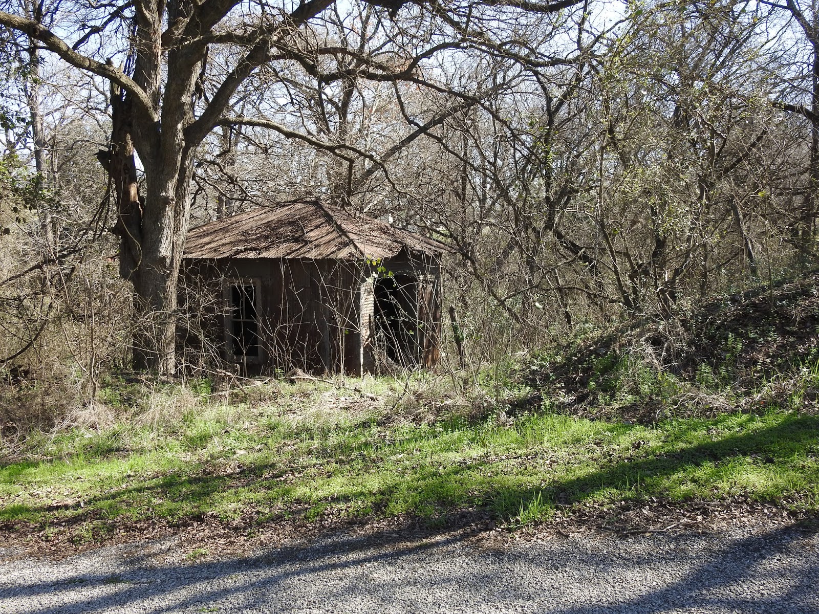
Figure 27.4 The pump house for the water project.
The project’s members
did almost all the work themselves including acquiring bank loans, ordering and
installing the pumps, erecting the water tower and laying the pipe ten feet
onto each member’s property. From there
each farmer laid pipe and installed faucets to the kitchen, barn, wherever they
wanted to have a water supply. No more
carrying water from the cistern and now a way to alleviate some of the effects
of the long drought. Irrigation was to
be limited to gardens and yard plants.
How did these small-
town farmers know how to successfully accomplish engineering this water
project? They were members of a small
community, most were on the same party[3]
line, they knew each other well and were accustomed to working together and
helping each other. A lawyer friend told
them how to set up an organization. The organization also had the help and
advice of local bankers, a friend who had already set up a water system in
McQueeney and in addition they got Alamo Iron Works of San Antonio involved.
They held meetings,
wrote bylaws and elected a board. Farmers mortgaged their property, funded the
Stagecoach Community Water System, and
became members. A member who owned the
land where the pump house was to be built, donated a 50-year land lease. They were
in business and construction began.
Once activity began,
members and other onlookers showed up to work or watch the progress. Finally, the day arrived to open the faucets
and flush the lines while a few housewives watched appalled as brown water gushed
forth. Reassured that it would clear,
they soon saw clear Guadalupe River water take its place.
Unfortunately,
nothing remains of this great community effort except for the pumphouse, the
underground piping and probably a few foundations covered over with vegetation.

Figure 27.5 Pumphouse foundation

Figure 27.6 Rusted remains of a buried pipe
Back in the car, we
returned to Hwy 725, turned right and traveled a short way until we saw Acme
Brick on our right. The site of the clay
pits and brick company has had many owners and is over 100 years old. The book author’s father worked here during
the drought years to add to the farm’s income.
And it was here in 1929 that he lost his life in a tragic accident at
the age of 39.
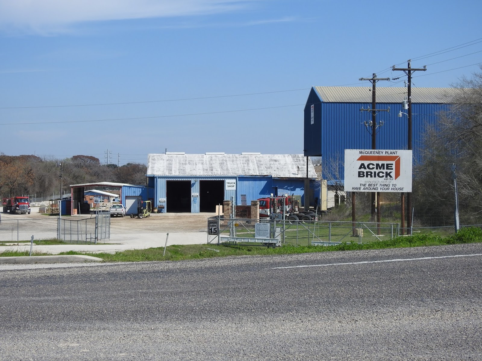
Figure 27.7 Acme Brick McQueeney Plant on 725.
The
plant no longer makes brick and tile as, we were told, the clay is much more
accessible in Kingsbury, and the bricks are made in the large modern plant in
Sealy. Some are hauled here for local
sales, but it is mostly used as a truck depot and repair garage. A man on duty
at the office showed us a brick with a Seguin imprint that was made back when
the plant was the Seguin Brick Company.
He then told us about a seam of blue clay discovered at this site that
was found to be loaded with fossilized sharks’ teeth.
We
returned to Stagecoach Road and with the telephoto lens took a couple of
pictures of old barns. Surrounded now by
mesquite trees they are left on the properties once owned by the author’s
father and grandfather.

Figure 27.8 Old barn on Stagecoach Road

Figure 27.9 Collapsed outbuilding on Stagecoach Road.

Figure 27.10 Site of the school the author attended.
The school was quite
close to the author’s home when he lived on Stagecoach Road. There are very few
traditional farmhouses with fields left on the road. And when we were there in early fall, the
crops that had been planted in the fields that were still producing were not cotton,
but field corn grown for animals. And, the new dwellers along this road have no
knowledge of the activity here 100 years ago.
Next on our agenda
was to visit the town of Marion. Back in the
early part of the twentieth century it was a bustling town. Today, the activity
in the town is less than in the past but it still has all the businesses for
local needs. A prominent feature of the
town is the huge hardware store that can supply just about anything a fellow
would need.

Figure 27.11 The General Merchandise store and bank
building in Marion, Texas, ca. 1920s.
This is
where the local farm families came for repair parts, tools, building materials,
pots, pans, buckets, plumbing supplies, you name it. They could ship their cotton and pick up
orders shipped to them from San Antonio and beyond. Also, over 100 years old,
the General Merchandise store is still there but now with a franchise name: Helping
Hands Hardware.

Figure 27.12
Hardware store Marion present day
The
exterior may look a bit different, but the interior looks much like it must
have looked in the old days. The
inventory is incredible and rises from the well- preserved wooden floor all the
way to the ceiling on neatly stacked shelves.

Figure 27.13 Inside of Helping Hands Hardware
Note
the old wooden ladder on rollers to access the upper shelves.
In Figure 7.11 you can see that cars were beginning to replace horses and even the train as a means of transportation. And the thrifty farmers became mechanics in many instances and learned to repair their own equipment using books and magazines to help them.

Figure 27.14 Ad in a Popular Mechanics magazine.
Tires
in those days were often victims of rough gravel roads and in one of the book’s
narrated incidents, a problematic tie rod had to be dealt with. One of the men sacrificed the tongue of his
leather shoe to make a temporary sleeved bearing for his engine that served
until the bearing could be replaced.
After Black Friday
and the onset of the Depression, women joined men in looking for work in
businesses and factories in towns and cities.
While families on farms turned to new ways to augment their living from
crops.

Figure 27.15 Ad in a Popular
Mechanics magazine.
Having
become a widow, the author’s mother assessed her situation and decided to lease
her home and farm to tenants and focus on her children’s education. She used her husband’s insurance money,
brickyard settlement and workmen’s compensation to pay off most of the farm’s
debts and build a smaller mini farm on almost three and a half acres on Zipp
Avenue in McQueeney. The children would
be closer to their new school and they would continue to raise chickens, cows
and pigs and sell eggs, milk and butter.
Just up the street lived her sister and her husband; her youngest sister
would be moving with her.
Recently,
we searched for this house built in 1930 and found it on Zipp Avenue.

Figure 27.16 The house on Zipp
Avenue

Figure 27.17 house on Zipp
Avenue 2020.
The
house appears to have changed very little over the last 90 years.
With
the discovery of this house, we had come to the last of the known existing
effects of three generations of the people featured in Stagecoach Road. And
while we were still thinking about lower roads in general, we decided to
revisit via, Google Earth, the lower road we grew up on in Michigan.
Known
as the Lower Ada Road by the old folks, Carl Drive, a gravel road peeled off
from M 21, went downhill a short distance and hooked up with Grand River Drive
another gravel road. The road paralleled
Grand River, unseen behind the hills, on its way to Ada. We put R’s old house number 5870 Grand River
Drive in Google Earth search box and were whisked to another enclave of three
generations. Across the road lived his grandmother and next to her his Aunt Mae
and cousin, JoAnn. And in 1946 Dee’s
family moved next door on two acres.
Now the gravel road
is paved and there’s even a sidewalk.
Behind his relatives’ homes was his grandparents’ vineyard. The vines produced table grapes to sell in
Grand Rapids and wine grapes for neighbor, Tommy Pugliesi. The vineyard was also where R’s grandfather
found a large stone Indian tool and his uncle uncovered a copper
spearhead. All the people living in
subdivisions along this ridge of land today probably have no idea what was here
in the past. They won’t know that Mr.
Martin let us kids play on his tennis court, range all over the pine forest he
planted. and skate on his pond. And, Mr.
Sarret let us make a ball diamond on his property on Alta Dale Drive. Then still on Alta Dale but over M- 21 we
fished and swam in Mikucki’s creek. No
one ever questioned our presence so we assumed it was okay to share the field
with the cows. We know what houses were present
in the 1940s and have pictures of most of them and remember who lived in
them. But the schoolhouse that used to sit on the
corner of Carl Dr. and Grand River Dr. has been moved into Ada and serves as a Country
Store. None of us who lived there at the
time live there today to pass on what existed in the 1940s. Looks like a good opportunity for another
book. This one to be titled This Old
Road.
______Sightings
Here
is a “never before” for us:
Several
of these snake-like “things” were spotted on the driveway this last week. From
six feet away, it looked like a slow- moving snake with no discernable head.
Close inspection showed it to be a well- organized troupe of bugs. We saw
something new, at least new to us.
Figure 7.17 Fungus Gnat Larvae
R &D Tusch
[1] All
may borrow it should you need to use one.
[2] Stagecoach
Road (Revisited) by Dalton Elley- 2002 revised by Steve Mardock –
2017. Available at the Wimberley Library
in the Book Club Section.
[3] A
telephone party line, meaning that it was shared with neighbors with each
member having a unique ring.


